Accessibility

Font Size

100% 150% 200%

Background Colour

Default Contrast
Close Reset

Woden Law Plantation

Enclosure (Period Unassigned)

Site Name Woden Law Plantation

Classification Enclosure (Period Unassigned)

Canmore ID 318233

Site Number NT71SE 173

NGR NT 76288 12788

Datum OSGB36 - NGR

Permalink http://canmore.org.uk/site/318233

Ordnance Survey licence number AC0000807262. All rights reserved.
Canmore Disclaimer. © Bluesky International Limited 2025. Public Sector Viewing Terms

Toggle Aerial | View on large map

Digital Images

Cheviot Hills, general view, showing Woden Law and Langside Law.  Oblique aerial photograph taken facing east.  This image has been produced from a print.

Administrative Areas

  • Council Scottish Borders, The
  • Parish Hownam
  • Former Region Borders
  • Former District Roxburgh
  • Former County Roxburghshire

Activities

Field Visit (25 September 1999)

NT71SE 173

Woden Law Plantation

Enclosure

NT 76288 12788

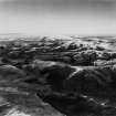
About 70m to the S of Woden Law Plantation, situated in rough pasture there is a turf banked enclosure. It is roughly hexagonal on plan and encloses an area of about 0.6ha.

Visited by RCAHMS (MFTR) 25 September 1999

References

MyCanmore Image Contributions


Contribute an Image

MyCanmore Text Contributions