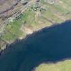
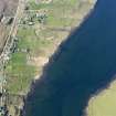
Accessibility

Font Size

100% 150% 200%

Background Colour

Default Contrast
Close Reset

River Snizort

Kelp Grid (Post Medieval)

Site Name River Snizort

Classification Kelp Grid (Post Medieval)

Alternative Name(s) Loch Snizort

Canmore ID 314271

Site Number NG45SW 60

NGR NG 4071 5034

Datum OSGB36 - NGR

Permalink http://canmore.org.uk/site/314271

Ordnance Survey licence number AC0000807262. All rights reserved.
Canmore Disclaimer. © Bluesky International Limited 2025. Public Sector Viewing Terms

Toggle Aerial | View on large map

Digital Images

Oblique aerial view of the remains of the fish traps and kelp grids in Loch Snizort, taken from the ESE.
Oblique aerial view of the remains of the fish traps and kelp grids in Loch Snizort, taken from the ESE.Oblique aerial view of the fish traps and kelp grids at River Snizort, looking NE.Oblique aerial view of the fish traps and kelp grids at River Snizort, looking SSE.Oblique aerial view of the fish traps and kelp grids at River Snizort, looking ENE.Oblique aerial view of the fish traps and kelp grids at River Snizort, looking NE.Oblique aerial view of the remains of the fish traps and kelp grids in Loch Snizort, taken from the W.Oblique aerial view of the fish traps and kelp grids at River Snizort, looking NE.General oblique aerial view looking up Loch Snizort towards the Skeabost Hotel with the remains of the fish traps and kelp grids in the foreground, taken from the N.General oblique aerial view looking up Loch Snizort towards the Skeabost Hotel with the remains of the fish traps and kelp grids in the foreground, taken from the N.Oblique aerial view of the fish traps and kelp grids at River Snizort, looking E.Oblique aerial view of the fish traps and kelp grids at River Snizort, Bernisdale, looking NNW.Oblique aerial view of the fish traps and kelp grids at River Snizort, looking SE.General oblique aerial view looking up Loch Snizort towards the Skeabost Hotel with the remains of the fish traps and kelp grids in the foreground, taken from the NNW.Oblique aerial view of the fish traps and kelp grids at River Snizort, looking E.Oblique aerial view of the remains of the fish traps and kelp grids in Loch Snizort, taken from the SE.Oblique aerial view of the remains of the fish traps and kelp grids in Loch Snizort, taken from the ESE.Oblique aerial view of the fish trap and kelp grids at River Snizort, looking E.Oblique aerial view of the fish trap and kelp grids at River Snizort, looking ENE.Oblique aerial view of the fish traps and kelp grids at River Snizort, looking SE.Oblique aerial view of the remains of the fish traps and kelp grids in Loch Snizort, taken from the SSE.Oblique aerial view of the fish traps and kelp grids at River Snizort, looking SE.Oblique aerial view of the fish trap and kelp grids at River Snizort, looking ENE.Oblique aerial view of the fish traps and kelp grids at River Snizort, Bernisdale, looking N.Oblique aerial view of the fish traps and kelp grids at River Snizort, Bernisdale, looking NNW.Oblique aerial view of the fish traps and kelp grids at River Snizort, looking W.

Administrative Areas

  • Council Highland
  • Parish Snizort
  • Former Region Highland
  • Former District Skye And Lochalsh
  • Former County Inverness-shire

References

MyCanmore Image Contributions


Contribute an Image

MyCanmore Text Contributions