
Following the launch of trove.scot in February 2025 we are now planning the retiral of some of our webservices. Canmore will be switched off on 24th June 2025. Information about the closure can be found on the HES website: Retiral of HES web services | Historic Environment Scotland
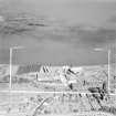
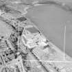
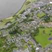
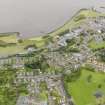
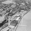
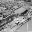
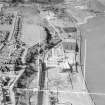
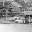
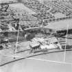
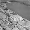
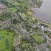
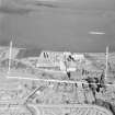
Bo'ness, Corbiehall, Works


Works (Period Unassigned)
Site Name Bo'ness, Corbiehall, Works
Classification Works (Period Unassigned)
Canmore ID 313326
Site Number NS98SE 209
NGR NS 99276 81480
Datum OSGB36 - NGR
Permalink http://canmore.org.uk/site/313326


- Council Falkirk
- Parish Bo'ness And Carriden
- Former Region Central
- Former District Falkirk
- Former County West Lothian
Characterisation
This site falls within the Corbiehall and Snab Area of Townscape Character (NS98SE 207), which was defined as part of the RCAHMS Urban Survey Programme 2013. Text relating to the historical development and topography, and present character of the Corbiehall and Snab Area of Townscape Character can be viewed at site NS98SE 207.
Information from RCAHMS (LK), January 2014

