
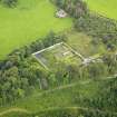
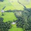
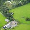
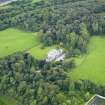
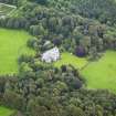
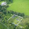
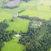
Kirkdale House, Walled Garden


Walled Garden (Period Unassigned)
Site Name Kirkdale House, Walled Garden
Classification Walled Garden (Period Unassigned)
Canmore ID 312886
Site Number NX55SW 112
NGR NX 5155 5351
Datum OSGB36 - NGR
Permalink http://canmore.org.uk/site/312886


- Council Dumfries And Galloway
- Parish Kirkmabreck
- Former Region Dumfries And Galloway
- Former District Wigtown
- Former County Kirkcudbrightshire

