Pricing Change
New pricing for orders of material from this site will come into place shortly. Charges for supply of digital images, digitisation on demand, prints and licensing will be altered.
Upcoming Maintenance
Please be advised that this website will undergo scheduled maintenance on the following dates:
Thursday, 9 January: 11:00 AM - 3:00 PM
Thursday, 23 January: 11:00 AM - 3:00 PM
Thursday, 30 January: 11:00 AM - 3:00 PM
During these times, some functionality such as image purchasing may be temporarily unavailable. We apologise for any inconvenience this may cause.
Bo'ness, Hillcrest And Brewlands Area Of Townscape Character
Town Quarter
Site Name Bo'ness, Hillcrest And Brewlands Area Of Townscape Character
Classification Town Quarter
Canmore ID 312663
Site Number NS98SE 203
NGR NS 99416 80388
Datum OSGB36 - NGR
Permalink http://canmore.org.uk/site/312663
- Council Falkirk
- Parish Bo'ness And Carriden
- Former Region Central
- Former District Falkirk
- Former County West Lothian
Characterisation (17 December 2013)
This site covers the Hillcrest and Brewlands Area of Townscape Character which was defined as part of the Bo'ness Urban Survey Project 2013. The text below relates to the whole area.
Historical Development and Topography
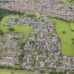
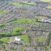
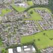
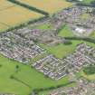
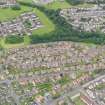
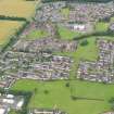
The Hillcrest and Brewlands Area of Townscape Character is a wholly 20th century creation consisting of three large housing developments which were created in the mid- to late 20th century, removing all trace of the 19th century Borrowstoun Mains farm, and Borrowstoun Farm farm buildings formerly occupying the southern edges of the area.
The three groups of housing developments were all built around 1970 by Walter Alison (1887-1950) & Robert Forbes Hutchison (1908-76) & Partners, and each have slightly different plan forms to achieve high density social housing surrounded by green space. Some of the housing was designed during the 1970s by James Gray (fl.1950s-1990s) for the Scottish Special Housing Association, which operated across Scotland from 1937 until the creation of Scottish Homes in 1989. The housing developments take their form in part from the topography of the area, being stepped up/down the ‘crest of the hill’ which formed part of the Antonine Wall running through the area. There has been no further infilling of the area since the developments were built, though many of the houses are now privately owned and there have been several elements of refurbishment.
Present Character
Although each of the areas has their own distinctive forms and features, all have been built in styles typical of the late 1960s/early 1970s. All have been built around a series of cul-de-sacs and pathways which give a conscious separation of pedestrians and cars in certain areas. The plan forms of the terraced housing comprise a mixture of stepped terraced housing on zig-zag pattern streets in the far west and the north-east. The developments in the central portion and the south-eastern area are more regularly planned, with large courtyards allowing parking and garages for nearby houses.
The plot sizes across the area are small, providing a high density residential area. There are no services or associated facilities within the area, but Deanburn School lies just south-west of the area in Kinneil Area of Townscape Character, and other facilities lie nearby to the east and north.
The most distinctive characteristic about the area to the north-east, around Mingle Park and Muirepark Court, is the use of monopitch roofs, with large expanses of weatherboarding or tile-hanging between the first floor and the ridge of the roof. The area around Brewlands Avenue to Friarspark Terrace in the far west of the area has terraced houses stepping up the hill in a distinctive zigzag street pattern. Each of these terraced houses is set back from the one before as they recede down the hill, and each has its own garage attached in front of the main house and direct access from the street.
Information from RCAHMS (LK), 17th December 2013


