
Following the launch of trove.scot in February 2025 we are now planning the retiral of some of our webservices. Canmore will be switched off on 24th June 2025. Information about the closure can be found on the HES website: Retiral of HES web services | Historic Environment Scotland
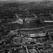
Edinburgh, Johnston Terrace


No Class (Event) (Period Unassigned)
Site Name Edinburgh, Johnston Terrace
Classification No Class (Event) (Period Unassigned)
Canmore ID 312347
Site Number NT27SE 6101
NGR NT 251 734
NGR Description NT 2570 7339 to NT 2523 7340
Datum OSGB36 - NGR
Permalink http://canmore.org.uk/site/312347

- Council Edinburgh, City Of
- Parish Edinburgh (Edinburgh, City Of)
- Former Region Lothian
- Former District City Of Edinburgh
- Former County Midlothian
Watching Brief (6 January 1998 - 8 January 1998)
A watching brief was carried out by Kirkdale Archaeology on work being done by the British Geological Survey on the S side of Edinburgh Castle's Esplanade, between the 6th and the 8th of January 1998. This was in response to serious slumps developing on the slopes between the Esplanade and Johnstone Terrace below. The intention was to run a series of resitivity survey lines down and across the slope to determine soil depth, and dig test pits along these lines in an attempt to establish the cause of the failures, and to suggest appropriate remedial measures. Due to the extreme slope of the site, a professional climbing service provided specialist equipment and advice.
None of the test pits produced an identical sequence, but TP 3 and 4, at the top of the slope both produced two dumps of mortar rich rubble, probably representing different episodes of contemporary dumping. TP 1 produced two discrete dumps of rubble, separated by two layers of clay. TP 2 produced an entirely different sequence, and it is notable that this was the only trench at the base of the slope next to Johnstone Terrace. The finds appear to show that there has been work carried out here more recently than at the top of the slope, where the finds might agree with a mid eighteenth century date for the majority of the material present. Unfortunately, due to the inherently variable nature of these deposits it would be impossible to relate the trenches to each other without further excavation. It is also to be regretted that excavation did not relate any of the excavated dumps to the upstanding revetment walls, although their absence from the 1877 Ordnance Survey map makes it likely that all of these are relatively recent. Indeed the finds of white china from TP 2 may relate to the construction of these walls.
Excavation then showed evidence for a surprising depth of deposits across this slope. This material is almost all likely to represent eighteenth century or later landscaping, raising the possibility that medieval features may survive under this material, if use was made of this area in that period. Unfortunately it was not possible to relate any of the upstanding walls to any of the excavated areas, however it seems likely, on cartographic grounds, that these all post-date 1877.
Sponsor: Historic Scotland
Kirkdale Archaeology 1998
Watching Brief (2 December 2013 - 4 December 2013)
NT 2511 7339 A watching brief was carried out, 2–4 December 2013, during the excavation of two trenches in advance of the installation of a new rock fall barrier on the N side of Johnston Terrace. There were no finds or features of archaeological significance.
Archive: RCAHMS (intended)
Funder: Historic Scotland
Alan Radley - Kirkdale Archaeology
(Source: DES)
Watching Brief (28 October 2015 - 1 March 2016)
NT 2514 7338 (centred on) A watching brief was maintained, 28 October 2015 – 1 March 2016, immediately below the S side of Edinburgh Castle, during path relocation work on the N side of the road. At Johnston Terrace’s SW end, where the present work was concentrated, it skirts the base of the cliffs that form this side of the rock, while further to the NE it runs across the slope below the esplanade. Earlier work had shown that well preserved deposits predating Johnston Terrace’s construction survived along its SE side at the NE end. This was thought to be at least partly because the NW (upslope) side was quarried into the slope, with the material removed from here spread to the SE to provide a level terrace for the road, sealing earlier deposits.
No evidence of natural in situ deposits were recorded in any of the monitored areas, with even the deepest areas of excavation, to 1.10m, containing only evidence of deposits of anthropogenic origin. This is almost certainly a testament to the immense amount of landscaping that the construction of Johnston Terrace involved. The SW end of the road feeds onto a substantial bridge crossing King’s Stables Road, with clear
evidence of the creation of a substantial bank connecting the lower end of Johnston Terrace to this bridge. Indeed, the regularity and coincidence of positioning of the whole slope below the lower end of Johnston Terrace suggests that this is all artificial, relating to the road’s construction.
Archive: NRHE (intended)
Funder: Historic Environment Scotland
Gordon Ewart – Kirkdale Archaeology
(Source: DES, Volume 17)

