
Pricing Change
New pricing for orders of material from this site will come into place shortly. Charges for supply of digital images, digitisation on demand, prints and licensing will be altered.
Westwind, Dunragit


No Class (Event) (Period Unassigned)
Site Name Westwind, Dunragit
Classification No Class (Event) (Period Unassigned)
Canmore ID 312192
Site Number NX15NE 158
NGR NX 1528 5734
Datum OSGB36 - NGR
Permalink http://canmore.org.uk/site/312192


- Council Dumfries And Galloway
- Parish Old Luce
- Former Region Dumfries And Galloway
- Former District Wigtown
- Former County Wigtownshire
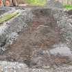
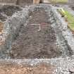
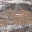
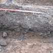
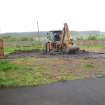
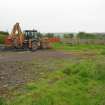
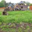
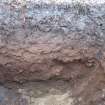
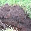
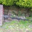
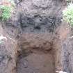
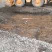
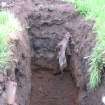
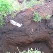
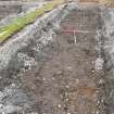
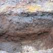
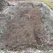
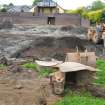
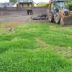
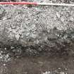
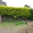
Watching Brief (20 May 2010)
NX 1528 5734 A watching brief was carried out on 20 May 2010 on the site of a proposed housing development. The site lies immediately adjacent to an extensive ritual landscape of Late Neolithic/Early Bronze Age date. No features of archaeological interest were identified on a site which had been heavily landscaped in the recent past.
Archive: RCAHMS. Report: Dumfries and Galloway Archaeology Service
Funder: Mr McCann
Louise Turner – Rathmell Archaeology Limited

