
Pricing Change
New pricing for orders of material from this site will come into place shortly. Charges for supply of digital images, digitisation on demand, prints and licensing will be altered.
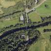
Crathie, St Manir's Church


Burial Ground (Post Medieval), Church (16th Century)
Site Name Crathie, St Manir's Church
Classification Burial Ground (Post Medieval), Church (16th Century)
Alternative Name(s) Creythyn; Crethy
Canmore ID 31159
Site Number NO29SE 4
NGR NO 2645 9471
Datum OSGB36 - NGR
Permalink http://canmore.org.uk/site/31159


- Council Aberdeenshire
- Parish Crathie And Braemar
- Former Region Grampian
- Former District Kincardine And Deeside
- Former County Aberdeenshire
NO29SE 4 2645 9471.
(NO 2645 9471) Church (NR) (In Ruins).
OS 6" map, Aberdeenshire, 2nd ed., (1903)
The church of Creythyn, or Crethy, was dedicated to St. Manir. It is first noticed in 1574 and again in 1606. Jervise states that the church belonged to the Abbey of Cambuskenneth but Scott says that it was owned by the Priory of Monymusk.
A Jervise 1875-9; H Scott 1915-61.
The remains of the church, built of random masonry with rubble infilling recently pointed, stand to gable height at the W end reducing to c.0.7m at the ends of the N and S walls. A modern burial enclosure obscures any trace there may be of the E wall. The enclosed space, which is taken up by gravestones, measures c.14.8m by c.5.4m. The walls are c.0.9m thick. Part of the S wall which incorporates a doorway, is modern.
Revised at 1/2500.
Visited by OS (R L) 24 October 1967.

