
Pricing Change
New pricing for orders of material from this site will come into place shortly. Charges for supply of digital images, digitisation on demand, prints and licensing will be altered.
Bute, Muirton Hill


Building (Period Unassigned)
Site Name Bute, Muirton Hill
Classification Building (Period Unassigned)
Canmore ID 311023
Site Number NS06NW 124
NGR NS 04257 68792
Datum OSGB36 - NGR
Permalink http://canmore.org.uk/site/311023

- Council Argyll And Bute
- Parish North Bute
- Former Region Strathclyde
- Former District Argyll And Bute
- Former County Buteshire
NS06NW 124 04257 68792
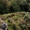
This building stands in rough moorland on the N side of an un-named stream that has cut a craggy, steep-sided gully into the W flank of Muirton Hill. Rectangular on plan, it measures 8m from NE to SW by 3.2m transversely over a stone wall about 0.8m in thickness but reduced to no more than 0.3m in height. The inner face of this wall is, at least in part, formed by edge-set stones.
Visited by RCAHMS (GG, JRS) 16 Sep 2010.

