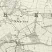
Rothiemay Castle, Manse
Manse (Period Unassigned)
Site Name Rothiemay Castle, Manse
Classification Manse (Period Unassigned)
Alternative Name(s) Rothiemay Castle Policies; Rothiemay Manse
Canmore ID 311009
Site Number NJ54NE 7.08
NGR NJ 55444 48501
NGR Description CENTRE OF SITE
Datum OSGB36 - NGR
Permalink http://canmore.org.uk/site/311009
- Council Moray
- Parish Rothiemay
- Former Region Grampian
- Former District Moray
- Former County Banffshire
For related sites see:
NJ54NE 7.00 NJ 55360 48459 Rothiemay Castle
NJ54NE 7.01 NJ 54807 48314 West Lodge
NJ54NE 7.02 NJ 55035 48276 Dovecot
NJ54NE 7.03 NJ 55122 48430 Kilnbarn
NJ54NE 7.04 NJ 55514 48168 Queen Mary's Bridge
NJ54NE 7.05 NJ 55099 48500 Mains of Rothiemay
NJ54NE 7.06 NJ 55514 48250 Kirktown of Rothiemay
NJ54NE 7.07 NJ 55417 48587 Laundry
NJ54NE 7.09 NJ 55480 48432 St Peter's Well
This manse is located within a 20th century coniferous plantation E of the Kirkton Burn. It was erected to replace the Kirktown of Rothiemay manse, which was demolished in 1752 as part of William Duff, Lord Braco's, improvements to the policies surrounding Rothiemay Castle. It was built by John Watson, mason, of Cullen in 1754 (Duff House Papers, Special Libraries and Archives, University of Aberdeen, MS 3175/648) and appears to have remained in use until 1827 when a larger manse was erected on the site of the present manse (NJ54NW 56), on the outskirts of the Milltown of Rothiemay. By 1900 it had been converted into the washhouse and laundry for Rothiemay Castle (NJ54NE 07) (William Cramond, “Rothiemay House,” The Banffshire Journal, Banff 1900).
The walls of the building are of field-gathered rubble construction with Avochie granite lintols, cills and quoins roughly dressed to straight arrises. The front and back ground floor window openings have one inch square checks. A number have iron hinge pins for flush shutters. Some of the window lintols also have sockets for four iron bars. Traces of lime render remain on the front face. Judging by the gables the slope of the roof appears to have been approximately 50 degrees. The roof sarking was still in place approximately 40 years ago, fixed up and down instead of along the slope, suggesting a purlin/frame structure beneath. Fragments of the grey slate that used to cover the roof can be seen around the building.
For further details regarding this and neighbouring sites lying within the policies of Rothiemay Castle, see the Kirkton of Rothiemay Survey Report, linked to this record.
Information from William Reid, May 2011.
Field Visit (1995 - 2011)
Measured and photographic survey.
This manse is located within a 20th century coniferous plantation E of the Kirkton Burn. It was erected to replace the Kirktown of Rothiemay manse, which was demolished in 1752 as part of William Duff, Lord Braco's, improvements to the policies surrounding Rothiemay Castle. It was built by John Watson, mason, of Cullen in 1754 (Duff House Papers, Special Libraries and Archives, University of Aberdeen, MS 3175/648) and appears to have remained in use until 1827 when a larger manse was erected on the site of the present manse (NJ54NW 56), on the outskirts of the Milltown of Rothiemay. By 1900 it had been converted into the washhouse and laundry for Rothiemay Castle (NJ54NE 07) (William Cramond, “Rothiemay House,” The Banffshire Journal, Banff 1900).
The walls of the building are of field-gathered rubble construction with Avochie granite lintols, cills and quoins roughly dressed to straight arrises. The front and back ground floor window openings have one inch square checks. A number have iron hinge pins for flush shutters. Some of the window lintols also have sockets for four iron bars. Traces of lime render remain on the front face. Judging by the gables the slope of the roof appears to have been approximately 50 degrees. The roof sarking was still in place approximately 40 years ago, fixed up and down instead of along the slope, suggesting a purlin/frame structure beneath. Fragments of the grey slate that used to cover the roof can be seen around the building.
For further details regarding this and neighbouring sites lying within the policies of Rothiemay Castle, see the Kirkton of Rothiemay Survey Report, linked to this record.
Information from William Reid, May 2011.


