
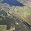
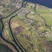
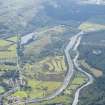
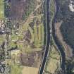
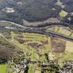
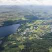
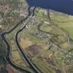
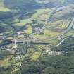
Fort Augustus, Market Hill, Fort Augustus Golf Course


Golf Course (20th Century) (1924)
Site Name Fort Augustus, Market Hill, Fort Augustus Golf Course
Classification Golf Course (20th Century) (1924)
Canmore ID 308992
Site Number NH30NW 9
NGR NH 37056 08335
NGR Description Centred NH 37056 08335
Datum OSGB36 - NGR
Permalink http://canmore.org.uk/site/308992


- Council Highland
- Parish Boleskine And Abertarff
- Former Region Highland
- Former District Inverness
- Former County Inverness-shire

