Following the launch of trove.scot in February 2025 we are now planning the retiral of some of our webservices. Canmore will be switched off on 24th June 2025. Information about the closure can be found on the HES website: Retiral of HES web services | Historic Environment Scotland
Errol Airfield
Airfield (20th Century), Prisoner Of War Camp (20th Century)(Possible)
Site Name Errol Airfield
Classification Airfield (20th Century), Prisoner Of War Camp (20th Century)(Possible)
Canmore ID 30473
Site Number NO22SE 18
NGR NO 27200 24270
NGR Description Centred NO 27200 24270
Datum OSGB36 - NGR
Permalink http://canmore.org.uk/site/30473
- Council Perth And Kinross
- Parish Errol
- Former Region Tayside
- Former District Perth And Kinross
- Former County Perthshire
NO22SE 18.00 centred 27200 23270
Airfield (disused) [NAT]
OS (GIS) MasterMap, May 2010.
NO22SE 18.01 centred NO 2730 2352 Dispersal Bays; Aircraft Hangars
NO22SE 18.02 NO 27098 24590 Control Tower
NO22SE 18.03 NO 26252 24130 Aircraft Hangar
NO22SE 18.04 centred NO 2705 2490 Buildings; Huts; Parachute Packing building
NO22SE 18.05 centred NO 2769 2438 Dispersal Bays; Aircraft Hangars
NO22SE 18.06 centred NO 2684 2338 Dispersal Bays; Aircraft Hangars
NO22SE 18.07 centred NO 2737 2489 Aircraft Hangars
NO22SE 18.08 centred NO 27311 25391 Buildings; Huts (assigned to NO22SE 18.00)
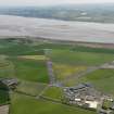
Errol opened on 1 August 1942 and was constructed with three runways. The airfield now lies derelict and its tower survives, as do many of the huts near the road.
D J Smith 1983
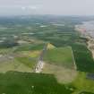
Situated on the S side of the A 90 trunk road. The control tower and many other buildings are extant, including one T1 hangar. The control tower is in a ruinous state, but many of the other buildings are still in use.
J Guy 2000; NMRS MS 810/9
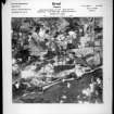
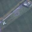
The airfield is visible on RAF WW II vertical air photographs (NLA 68, 3089-3091, 4088-4092, flown 27 August 1943), which show that at that date the airfield had five large hangars and 13 Blister hangars linked to dispersal area can be seen around the perimeter.
The technical area in the NE corner consisted of several smaller structures all relating to the servicing and repair of aircraft.
One hangar (T1 type) survives (NO22SE 18.3) adjacent to East Leys farmsteading and the control tower lies within the perimeter track on the NE side of the airfield.
Vertical air photographs taken in 1988 (All Scotland Survey, 50788, frames 226-227, flown 10 June 1988) show that the runways survive, but most of the dispersal areas have been converted back to arable land, though some appear as cropmarks on the 1988 imagery. Nearly all the hangars have been removed and a go-karting circuit has been built on the W side of the airfield between the perimeter track and the NW-SE runway.
Information from RCAHMS (DE), September 2005
Part of this airfield may have been utilised as a prisoner of war camp. Noted in English Heritage list of PoW camps.
R J C Thomas, Project Report. Twentieth Century Military Recording Project, Prisoner of war camps (1939-1948), July 2003.


