
Dunbar, Hallhill


Ditch (Medieval), Ditch (Prehistoric), Pit (Prehistoric), Organic Material (Period Unassigned), Unidentified Pottery (Medieval), Unidentified Pottery (Post Medieval)
Site Name Dunbar, Hallhill
Classification Ditch (Medieval), Ditch (Prehistoric), Pit (Prehistoric), Organic Material (Period Unassigned), Unidentified Pottery (Medieval), Unidentified Pottery (Post Medieval)
Canmore ID 304463
Site Number NT67NE 547
NGR NT 6699 7767
Datum OSGB36 - NGR
Permalink http://canmore.org.uk/site/304463
Ordnance Survey licence number AC0000807262. All rights reserved.
Canmore Disclaimer.
© Bluesky International Limited 2025. Public Sector Viewing Terms
- Correction
- Favourite

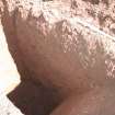
DP 184680
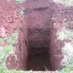
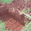
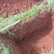
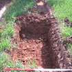
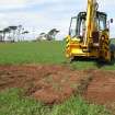
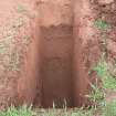
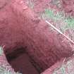
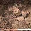
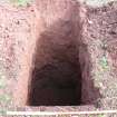
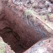
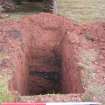
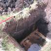
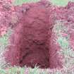
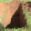
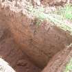
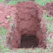
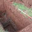
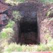
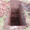
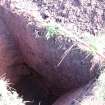
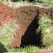
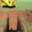
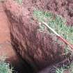
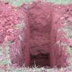
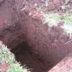
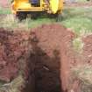
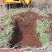
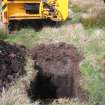
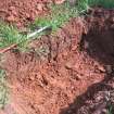
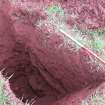
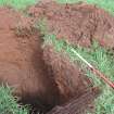
Image from test pitting for desked based assessment and watching brief at Hallhill, Dunbar.
Records of Rathmell Archaeology Ltd, archaeologists, Kilbarchan, Renfrewshire, Scotland
4/2008
© Copyright: Rathmell Archaeology Ltd.. Courtesy of HES.

DP 184681
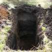
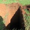
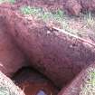
Image from test pitting for desked based assessment and watching brief at Hallhill, Dunbar.
Records of Rathmell Archaeology Ltd, archaeologists, Kilbarchan, Renfrewshire, Scotland
4/2008
© Copyright: Rathmell Archaeology Ltd.. Courtesy of HES.

DP 184696
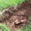
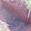
Image from test pitting for desked based assessment and watching brief at Hallhill, Dunbar.
Records of Rathmell Archaeology Ltd, archaeologists, Kilbarchan, Renfrewshire, Scotland
4/2008
© Copyright: Rathmell Archaeology Ltd.. Courtesy of HES.

DP 184698
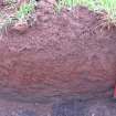
Image from test pitting for desked based assessment and watching brief at Hallhill, Dunbar.
Records of Rathmell Archaeology Ltd, archaeologists, Kilbarchan, Renfrewshire, Scotland
4/2008
© Copyright: Rathmell Archaeology Ltd.. Courtesy of HES.

DP 184705
Image from test pitting for desked based assessment and watching brief at Hallhill, Dunbar.
Records of Rathmell Archaeology Ltd, archaeologists, Kilbarchan, Renfrewshire, Scotland
4/2008
© Copyright: Rathmell Archaeology Ltd.. Courtesy of HES.

DP 184715
Image from test pitting for desked based assessment and watching brief at Hallhill, Dunbar.
Records of Rathmell Archaeology Ltd, archaeologists, Kilbarchan, Renfrewshire, Scotland
4/2008
© Copyright: Rathmell Archaeology Ltd.. Courtesy of HES.

DP 184718
Image from test pitting for desked based assessment and watching brief at Hallhill, Dunbar.
Records of Rathmell Archaeology Ltd, archaeologists, Kilbarchan, Renfrewshire, Scotland
4/2008
© Copyright: Rathmell Archaeology Ltd.. Courtesy of HES.

DP 184731
Image from test pitting for desked based assessment and watching brief at Hallhill, Dunbar.
Records of Rathmell Archaeology Ltd, archaeologists, Kilbarchan, Renfrewshire, Scotland
4/2008
© Copyright: Rathmell Archaeology Ltd.. Courtesy of HES.

DP 184734
Image from test pitting for desked based assessment and watching brief at Hallhill, Dunbar.
Records of Rathmell Archaeology Ltd, archaeologists, Kilbarchan, Renfrewshire, Scotland
4/2008
© Copyright: Rathmell Archaeology Ltd.. Courtesy of HES.

DP 184752
Image from test pitting for desked based assessment and watching brief at Hallhill, Dunbar.
Records of Rathmell Archaeology Ltd, archaeologists, Kilbarchan, Renfrewshire, Scotland
4/2008
© Copyright: Rathmell Archaeology Ltd.. Courtesy of HES.

DP 184763
Image from test pitting for desked based assessment and watching brief at Hallhill, Dunbar.
Records of Rathmell Archaeology Ltd, archaeologists, Kilbarchan, Renfrewshire, Scotland
4/2008
© Copyright: Rathmell Archaeology Ltd.. Courtesy of HES.

DP 184765
Image from test pitting for desked based assessment and watching brief at Hallhill, Dunbar.
Records of Rathmell Archaeology Ltd, archaeologists, Kilbarchan, Renfrewshire, Scotland
4/2008
© Copyright: Rathmell Archaeology Ltd.. Courtesy of HES.

DP 184768
Image from test pitting for desked based assessment and watching brief at Hallhill, Dunbar.
Records of Rathmell Archaeology Ltd, archaeologists, Kilbarchan, Renfrewshire, Scotland
4/2008
© Copyright: Rathmell Archaeology Ltd.. Courtesy of HES.

DP 184792
Image from test pitting for desked based assessment and watching brief at Hallhill, Dunbar.
Records of Rathmell Archaeology Ltd, archaeologists, Kilbarchan, Renfrewshire, Scotland
4/2008
© Copyright: Rathmell Archaeology Ltd.. Courtesy of HES.

DP 184798
Image from test pitting for desked based assessment and watching brief at Hallhill, Dunbar.
Records of Rathmell Archaeology Ltd, archaeologists, Kilbarchan, Renfrewshire, Scotland
4/2008
© Copyright: Rathmell Archaeology Ltd.. Courtesy of HES.

DP 184799
Image from test pitting for desked based assessment and watching brief at Hallhill, Dunbar.
Records of Rathmell Archaeology Ltd, archaeologists, Kilbarchan, Renfrewshire, Scotland
4/2008
© Copyright: Rathmell Archaeology Ltd.. Courtesy of HES.

DP 184800
Image from test pitting for desked based assessment and watching brief at Hallhill, Dunbar.
Records of Rathmell Archaeology Ltd, archaeologists, Kilbarchan, Renfrewshire, Scotland
4/2008
© Copyright: Rathmell Archaeology Ltd.. Courtesy of HES.

DP 184808
Image from test pitting for desked based assessment and watching brief at Hallhill, Dunbar.
Records of Rathmell Archaeology Ltd, archaeologists, Kilbarchan, Renfrewshire, Scotland
4/2008
© Copyright: Rathmell Archaeology Ltd.. Courtesy of HES.

DP 184809
Image from test pitting for desked based assessment and watching brief at Hallhill, Dunbar.
Records of Rathmell Archaeology Ltd, archaeologists, Kilbarchan, Renfrewshire, Scotland
4/2008
© Copyright: Rathmell Archaeology Ltd.. Courtesy of HES.

DP 184812
Image from test pitting for desked based assessment and watching brief at Hallhill, Dunbar.
Records of Rathmell Archaeology Ltd, archaeologists, Kilbarchan, Renfrewshire, Scotland
4/2008
© Copyright: Rathmell Archaeology Ltd.. Courtesy of HES.

DP 184819
Image from test pitting for desked based assessment and watching brief at Hallhill, Dunbar.
Records of Rathmell Archaeology Ltd, archaeologists, Kilbarchan, Renfrewshire, Scotland
4/2008
© Copyright: Rathmell Archaeology Ltd.. Courtesy of HES.

DP 184823
Image from test pitting for desked based assessment and watching brief at Hallhill, Dunbar.
Records of Rathmell Archaeology Ltd, archaeologists, Kilbarchan, Renfrewshire, Scotland
4/2008
© Copyright: Rathmell Archaeology Ltd.. Courtesy of HES.

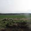
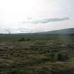
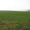
DP 185234
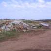
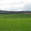
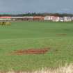
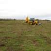
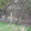
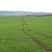
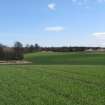
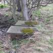
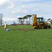
Image from walkover survey for desked based assessment and watching brief at Hallhill, Dunbar.
Records of Rathmell Archaeology Ltd, archaeologists, Kilbarchan, Renfrewshire, Scotland
4/2008
© Copyright: Rathmell Archaeology Ltd.. Courtesy of HES.

DP 185243
Image from walkover survey for desked based assessment and watching brief at Hallhill, Dunbar.
Records of Rathmell Archaeology Ltd, archaeologists, Kilbarchan, Renfrewshire, Scotland
4/2008
© Copyright: Rathmell Archaeology Ltd.. Courtesy of HES.

DP 185263
Image from walkover survey for desked based assessment and watching brief at Hallhill, Dunbar.
Records of Rathmell Archaeology Ltd, archaeologists, Kilbarchan, Renfrewshire, Scotland
4/2008
© Copyright: Rathmell Archaeology Ltd.. Courtesy of HES.

DP 185288
Image from walkover survey for desked based assessment and watching brief at Hallhill, Dunbar.
Records of Rathmell Archaeology Ltd, archaeologists, Kilbarchan, Renfrewshire, Scotland
4/2008
© Copyright: Rathmell Archaeology Ltd.. Courtesy of HES.

DP 185290
Image from walkover survey for desked based assessment and watching brief at Hallhill, Dunbar.
Records of Rathmell Archaeology Ltd, archaeologists, Kilbarchan, Renfrewshire, Scotland
4/2008
© Copyright: Rathmell Archaeology Ltd.. Courtesy of HES.

DP 185291
Image from walkover survey for desked based assessment and watching brief at Hallhill, Dunbar.
Records of Rathmell Archaeology Ltd, archaeologists, Kilbarchan, Renfrewshire, Scotland
4/2008
© Copyright: Rathmell Archaeology Ltd.. Courtesy of HES.

DP 185294
Image from walkover survey for desked based assessment and watching brief at Hallhill, Dunbar.
Records of Rathmell Archaeology Ltd, archaeologists, Kilbarchan, Renfrewshire, Scotland
4/2008
© Copyright: Rathmell Archaeology Ltd.. Courtesy of HES.

DP 185305
Image from walkover survey for desked based assessment and watching brief at Hallhill, Dunbar.
Records of Rathmell Archaeology Ltd, archaeologists, Kilbarchan, Renfrewshire, Scotland
4/2008
© Copyright: Rathmell Archaeology Ltd.. Courtesy of HES.

DP 185306
Image from walkover survey for desked based assessment and watching brief at Hallhill, Dunbar.
Records of Rathmell Archaeology Ltd, archaeologists, Kilbarchan, Renfrewshire, Scotland
4/2008
© Copyright: Rathmell Archaeology Ltd.. Courtesy of HES.

DP 184689
Image from test pitting for desked based assessment and watching brief at Hallhill, Dunbar.
Records of Rathmell Archaeology Ltd, archaeologists, Kilbarchan, Renfrewshire, Scotland
4/2008
© Copyright: Rathmell Archaeology Ltd.. Courtesy of HES.

DP 184702
Image from test pitting for desked based assessment and watching brief at Hallhill, Dunbar.
Records of Rathmell Archaeology Ltd, archaeologists, Kilbarchan, Renfrewshire, Scotland
4/2008
© Copyright: Rathmell Archaeology Ltd.. Courtesy of HES.

DP 184714
Image from test pitting for desked based assessment and watching brief at Hallhill, Dunbar.
Records of Rathmell Archaeology Ltd, archaeologists, Kilbarchan, Renfrewshire, Scotland
4/2008
© Copyright: Rathmell Archaeology Ltd.. Courtesy of HES.

DP 184720
Image from test pitting for desked based assessment and watching brief at Hallhill, Dunbar.
Records of Rathmell Archaeology Ltd, archaeologists, Kilbarchan, Renfrewshire, Scotland
4/2008
© Copyright: Rathmell Archaeology Ltd.. Courtesy of HES.

DP 184750
Image from test pitting for desked based assessment and watching brief at Hallhill, Dunbar.
Records of Rathmell Archaeology Ltd, archaeologists, Kilbarchan, Renfrewshire, Scotland
4/2008
© Copyright: Rathmell Archaeology Ltd.. Courtesy of HES.

DP 184754
Image from test pitting for desked based assessment and watching brief at Hallhill, Dunbar.
Records of Rathmell Archaeology Ltd, archaeologists, Kilbarchan, Renfrewshire, Scotland
4/2008
© Copyright: Rathmell Archaeology Ltd.. Courtesy of HES.

DP 184757
Image from test pitting for desked based assessment and watching brief at Hallhill, Dunbar.
Records of Rathmell Archaeology Ltd, archaeologists, Kilbarchan, Renfrewshire, Scotland
4/2008
© Copyright: Rathmell Archaeology Ltd.. Courtesy of HES.

DP 184758
Image from test pitting for desked based assessment and watching brief at Hallhill, Dunbar.
Records of Rathmell Archaeology Ltd, archaeologists, Kilbarchan, Renfrewshire, Scotland
4/2008
© Copyright: Rathmell Archaeology Ltd.. Courtesy of HES.

DP 184769
Image from test pitting for desked based assessment and watching brief at Hallhill, Dunbar.
Records of Rathmell Archaeology Ltd, archaeologists, Kilbarchan, Renfrewshire, Scotland
4/2008
© Copyright: Rathmell Archaeology Ltd.. Courtesy of HES.

DP 184776
Image from test pitting for desked based assessment and watching brief at Hallhill, Dunbar.
Records of Rathmell Archaeology Ltd, archaeologists, Kilbarchan, Renfrewshire, Scotland
4/2008
© Copyright: Rathmell Archaeology Ltd.. Courtesy of HES.

DP 184786
Image from test pitting for desked based assessment and watching brief at Hallhill, Dunbar.
Records of Rathmell Archaeology Ltd, archaeologists, Kilbarchan, Renfrewshire, Scotland
4/2008
© Copyright: Rathmell Archaeology Ltd.. Courtesy of HES.

DP 184788
Image from test pitting for desked based assessment and watching brief at Hallhill, Dunbar.
Records of Rathmell Archaeology Ltd, archaeologists, Kilbarchan, Renfrewshire, Scotland
4/2008
© Copyright: Rathmell Archaeology Ltd.. Courtesy of HES.

DP 184811
Image from test pitting for desked based assessment and watching brief at Hallhill, Dunbar.
Records of Rathmell Archaeology Ltd, archaeologists, Kilbarchan, Renfrewshire, Scotland
4/2008
© Copyright: Rathmell Archaeology Ltd.. Courtesy of HES.

DP 184816
Image from test pitting for desked based assessment and watching brief at Hallhill, Dunbar.
Records of Rathmell Archaeology Ltd, archaeologists, Kilbarchan, Renfrewshire, Scotland
4/2008
© Copyright: Rathmell Archaeology Ltd.. Courtesy of HES.

DP 184821
Image from test pitting for desked based assessment and watching brief at Hallhill, Dunbar.
Records of Rathmell Archaeology Ltd, archaeologists, Kilbarchan, Renfrewshire, Scotland
4/2008
© Copyright: Rathmell Archaeology Ltd.. Courtesy of HES.

DP 184824
Image from test pitting for desked based assessment and watching brief at Hallhill, Dunbar.
Records of Rathmell Archaeology Ltd, archaeologists, Kilbarchan, Renfrewshire, Scotland
4/2008
© Copyright: Rathmell Archaeology Ltd.. Courtesy of HES.

DP 185248
Image from walkover survey for desked based assessment and watching brief at Hallhill, Dunbar.
Records of Rathmell Archaeology Ltd, archaeologists, Kilbarchan, Renfrewshire, Scotland
4/2008
© Copyright: Rathmell Archaeology Ltd.. Courtesy of HES.

DP 185249
Image from walkover survey for desked based assessment and watching brief at Hallhill, Dunbar.
Records of Rathmell Archaeology Ltd, archaeologists, Kilbarchan, Renfrewshire, Scotland
4/2008
© Copyright: Rathmell Archaeology Ltd.. Courtesy of HES.

DP 185259
Image from walkover survey for desked based assessment and watching brief at Hallhill, Dunbar.
Records of Rathmell Archaeology Ltd, archaeologists, Kilbarchan, Renfrewshire, Scotland
4/2008
© Copyright: Rathmell Archaeology Ltd.. Courtesy of HES.

DP 185269
Image from walkover survey for desked based assessment and watching brief at Hallhill, Dunbar.
Records of Rathmell Archaeology Ltd, archaeologists, Kilbarchan, Renfrewshire, Scotland
4/2008
© Copyright: Rathmell Archaeology Ltd.. Courtesy of HES.

DP 185270
Image from walkover survey for desked based assessment and watching brief at Hallhill, Dunbar.
Records of Rathmell Archaeology Ltd, archaeologists, Kilbarchan, Renfrewshire, Scotland
4/2008
© Copyright: Rathmell Archaeology Ltd.. Courtesy of HES.

DP 185279
Image from walkover survey for desked based assessment and watching brief at Hallhill, Dunbar.
Records of Rathmell Archaeology Ltd, archaeologists, Kilbarchan, Renfrewshire, Scotland
4/2008
© Copyright: Rathmell Archaeology Ltd.. Courtesy of HES.

DP 185281
Image from walkover survey for desked based assessment and watching brief at Hallhill, Dunbar.
Records of Rathmell Archaeology Ltd, archaeologists, Kilbarchan, Renfrewshire, Scotland
4/2008
© Copyright: Rathmell Archaeology Ltd.. Courtesy of HES.

DP 185293
Image from walkover survey for desked based assessment and watching brief at Hallhill, Dunbar.
Records of Rathmell Archaeology Ltd, archaeologists, Kilbarchan, Renfrewshire, Scotland
4/2008
© Copyright: Rathmell Archaeology Ltd.. Courtesy of HES.

DP 185310
Image from walkover survey for desked based assessment and watching brief at Hallhill, Dunbar.
Records of Rathmell Archaeology Ltd, archaeologists, Kilbarchan, Renfrewshire, Scotland
4/2008
© Copyright: Rathmell Archaeology Ltd.. Courtesy of HES.

DP 185311
Image from walkover survey for desked based assessment and watching brief at Hallhill, Dunbar.
Records of Rathmell Archaeology Ltd, archaeologists, Kilbarchan, Renfrewshire, Scotland
4/2008
© Copyright: Rathmell Archaeology Ltd.. Courtesy of HES.

DP 185315
Image from walkover survey for desked based assessment and watching brief at Hallhill, Dunbar.
Records of Rathmell Archaeology Ltd, archaeologists, Kilbarchan, Renfrewshire, Scotland
4/2008
© Copyright: Rathmell Archaeology Ltd.. Courtesy of HES.

DP 184683
Image from test pitting for desked based assessment and watching brief at Hallhill, Dunbar.
Records of Rathmell Archaeology Ltd, archaeologists, Kilbarchan, Renfrewshire, Scotland
4/2008
© Copyright: Rathmell Archaeology Ltd.. Courtesy of HES.

DP 184692
Image from test pitting for desked based assessment and watching brief at Hallhill, Dunbar.
Records of Rathmell Archaeology Ltd, archaeologists, Kilbarchan, Renfrewshire, Scotland
4/2008
© Copyright: Rathmell Archaeology Ltd.. Courtesy of HES.

DP 184703
Image from test pitting for desked based assessment and watching brief at Hallhill, Dunbar.
Records of Rathmell Archaeology Ltd, archaeologists, Kilbarchan, Renfrewshire, Scotland
4/2008
© Copyright: Rathmell Archaeology Ltd.. Courtesy of HES.

DP 184708
Image from test pitting for desked based assessment and watching brief at Hallhill, Dunbar.
Records of Rathmell Archaeology Ltd, archaeologists, Kilbarchan, Renfrewshire, Scotland
4/2008
© Copyright: Rathmell Archaeology Ltd.. Courtesy of HES.

DP 184709
Image from test pitting for desked based assessment and watching brief at Hallhill, Dunbar.
Records of Rathmell Archaeology Ltd, archaeologists, Kilbarchan, Renfrewshire, Scotland
4/2008
© Copyright: Rathmell Archaeology Ltd.. Courtesy of HES.

DP 184725
Image from test pitting for desked based assessment and watching brief at Hallhill, Dunbar.
Records of Rathmell Archaeology Ltd, archaeologists, Kilbarchan, Renfrewshire, Scotland
4/2008
© Copyright: Rathmell Archaeology Ltd.. Courtesy of HES.

DP 184728
Image from test pitting for desked based assessment and watching brief at Hallhill, Dunbar.
Records of Rathmell Archaeology Ltd, archaeologists, Kilbarchan, Renfrewshire, Scotland
4/2008
© Copyright: Rathmell Archaeology Ltd.. Courtesy of HES.

DP 184729
Image from test pitting for desked based assessment and watching brief at Hallhill, Dunbar.
Records of Rathmell Archaeology Ltd, archaeologists, Kilbarchan, Renfrewshire, Scotland
4/2008
© Copyright: Rathmell Archaeology Ltd.. Courtesy of HES.

DP 184732
Image from test pitting for desked based assessment and watching brief at Hallhill, Dunbar.
Records of Rathmell Archaeology Ltd, archaeologists, Kilbarchan, Renfrewshire, Scotland
4/2008
© Copyright: Rathmell Archaeology Ltd.. Courtesy of HES.

DP 184739
Image from test pitting for desked based assessment and watching brief at Hallhill, Dunbar.
Records of Rathmell Archaeology Ltd, archaeologists, Kilbarchan, Renfrewshire, Scotland
4/2008
© Copyright: Rathmell Archaeology Ltd.. Courtesy of HES.

DP 184744
Image from test pitting for desked based assessment and watching brief at Hallhill, Dunbar.
Records of Rathmell Archaeology Ltd, archaeologists, Kilbarchan, Renfrewshire, Scotland
4/2008
© Copyright: Rathmell Archaeology Ltd.. Courtesy of HES.

DP 184749
Image from test pitting for desked based assessment and watching brief at Hallhill, Dunbar.
Records of Rathmell Archaeology Ltd, archaeologists, Kilbarchan, Renfrewshire, Scotland
4/2008
© Copyright: Rathmell Archaeology Ltd.. Courtesy of HES.

DP 184759
Image from test pitting for desked based assessment and watching brief at Hallhill, Dunbar.
Records of Rathmell Archaeology Ltd, archaeologists, Kilbarchan, Renfrewshire, Scotland
4/2008
© Copyright: Rathmell Archaeology Ltd.. Courtesy of HES.

DP 184767
Image from test pitting for desked based assessment and watching brief at Hallhill, Dunbar.
Records of Rathmell Archaeology Ltd, archaeologists, Kilbarchan, Renfrewshire, Scotland
4/2008
© Copyright: Rathmell Archaeology Ltd.. Courtesy of HES.

DP 184773
Image from test pitting for desked based assessment and watching brief at Hallhill, Dunbar.
Records of Rathmell Archaeology Ltd, archaeologists, Kilbarchan, Renfrewshire, Scotland
4/2008
© Copyright: Rathmell Archaeology Ltd.. Courtesy of HES.

DP 184780
Image from test pitting for desked based assessment and watching brief at Hallhill, Dunbar.
Records of Rathmell Archaeology Ltd, archaeologists, Kilbarchan, Renfrewshire, Scotland
4/2008
© Copyright: Rathmell Archaeology Ltd.. Courtesy of HES.

DP 184785
Image from test pitting for desked based assessment and watching brief at Hallhill, Dunbar.
Records of Rathmell Archaeology Ltd, archaeologists, Kilbarchan, Renfrewshire, Scotland
4/2008
© Copyright: Rathmell Archaeology Ltd.. Courtesy of HES.

DP 184801
Image from test pitting for desked based assessment and watching brief at Hallhill, Dunbar.
Records of Rathmell Archaeology Ltd, archaeologists, Kilbarchan, Renfrewshire, Scotland
4/2008
© Copyright: Rathmell Archaeology Ltd.. Courtesy of HES.

DP 184806
Image from test pitting for desked based assessment and watching brief at Hallhill, Dunbar.
Records of Rathmell Archaeology Ltd, archaeologists, Kilbarchan, Renfrewshire, Scotland
4/2008
© Copyright: Rathmell Archaeology Ltd.. Courtesy of HES.

DP 184817
Image from test pitting for desked based assessment and watching brief at Hallhill, Dunbar.
Records of Rathmell Archaeology Ltd, archaeologists, Kilbarchan, Renfrewshire, Scotland
4/2008
© Copyright: Rathmell Archaeology Ltd.. Courtesy of HES.

DP 184830
Image from test pitting for desked based assessment and watching brief at Hallhill, Dunbar.
Records of Rathmell Archaeology Ltd, archaeologists, Kilbarchan, Renfrewshire, Scotland
4/2008
© Copyright: Rathmell Archaeology Ltd.. Courtesy of HES.

DP 185233
Image from walkover survey for desked based assessment and watching brief at Hallhill, Dunbar.
Records of Rathmell Archaeology Ltd, archaeologists, Kilbarchan, Renfrewshire, Scotland
4/2008
© Copyright: Rathmell Archaeology Ltd.. Courtesy of HES.

DP 185242
Image from walkover survey for desked based assessment and watching brief at Hallhill, Dunbar.
Records of Rathmell Archaeology Ltd, archaeologists, Kilbarchan, Renfrewshire, Scotland
4/2008
© Copyright: Rathmell Archaeology Ltd.. Courtesy of HES.

DP 185244
Image from walkover survey for desked based assessment and watching brief at Hallhill, Dunbar.
Records of Rathmell Archaeology Ltd, archaeologists, Kilbarchan, Renfrewshire, Scotland
4/2008
© Copyright: Rathmell Archaeology Ltd.. Courtesy of HES.

DP 185247
Image from walkover survey for desked based assessment and watching brief at Hallhill, Dunbar.
Records of Rathmell Archaeology Ltd, archaeologists, Kilbarchan, Renfrewshire, Scotland
4/2008
© Copyright: Rathmell Archaeology Ltd.. Courtesy of HES.

DP 185253
Image from walkover survey for desked based assessment and watching brief at Hallhill, Dunbar.
Records of Rathmell Archaeology Ltd, archaeologists, Kilbarchan, Renfrewshire, Scotland
4/2008
© Copyright: Rathmell Archaeology Ltd.. Courtesy of HES.

DP 185260
Image from walkover survey for desked based assessment and watching brief at Hallhill, Dunbar.
Records of Rathmell Archaeology Ltd, archaeologists, Kilbarchan, Renfrewshire, Scotland
4/2008
© Copyright: Rathmell Archaeology Ltd.. Courtesy of HES.

DP 185271
Image from walkover survey for desked based assessment and watching brief at Hallhill, Dunbar.
Records of Rathmell Archaeology Ltd, archaeologists, Kilbarchan, Renfrewshire, Scotland
4/2008
© Copyright: Rathmell Archaeology Ltd.. Courtesy of HES.

DP 185299
Image from walkover survey for desked based assessment and watching brief at Hallhill, Dunbar.
Records of Rathmell Archaeology Ltd, archaeologists, Kilbarchan, Renfrewshire, Scotland
4/2008
© Copyright: Rathmell Archaeology Ltd.. Courtesy of HES.

DP 185302
Image from walkover survey for desked based assessment and watching brief at Hallhill, Dunbar.
Records of Rathmell Archaeology Ltd, archaeologists, Kilbarchan, Renfrewshire, Scotland
4/2008
© Copyright: Rathmell Archaeology Ltd.. Courtesy of HES.

DP 185316
Image from walkover survey for desked based assessment and watching brief at Hallhill, Dunbar.
Records of Rathmell Archaeology Ltd, archaeologists, Kilbarchan, Renfrewshire, Scotland
4/2008
© Copyright: Rathmell Archaeology Ltd.. Courtesy of HES.

DP 184682
Image from test pitting for desked based assessment and watching brief at Hallhill, Dunbar.
Records of Rathmell Archaeology Ltd, archaeologists, Kilbarchan, Renfrewshire, Scotland
4/2008
© Copyright: Rathmell Archaeology Ltd.. Courtesy of HES.

DP 184685
Image from test pitting for desked based assessment and watching brief at Hallhill, Dunbar.
Records of Rathmell Archaeology Ltd, archaeologists, Kilbarchan, Renfrewshire, Scotland
4/2008
© Copyright: Rathmell Archaeology Ltd.. Courtesy of HES.

DP 184691
Image from test pitting for desked based assessment and watching brief at Hallhill, Dunbar.
Records of Rathmell Archaeology Ltd, archaeologists, Kilbarchan, Renfrewshire, Scotland
4/2008
© Copyright: Rathmell Archaeology Ltd.. Courtesy of HES.

DP 184701
Image from test pitting for desked based assessment and watching brief at Hallhill, Dunbar.
Records of Rathmell Archaeology Ltd, archaeologists, Kilbarchan, Renfrewshire, Scotland
4/2008
© Copyright: Rathmell Archaeology Ltd.. Courtesy of HES.

DP 184706
Image from test pitting for desked based assessment and watching brief at Hallhill, Dunbar.
Records of Rathmell Archaeology Ltd, archaeologists, Kilbarchan, Renfrewshire, Scotland
4/2008
© Copyright: Rathmell Archaeology Ltd.. Courtesy of HES.

DP 184711
Image from test pitting for desked based assessment and watching brief at Hallhill, Dunbar.
Records of Rathmell Archaeology Ltd, archaeologists, Kilbarchan, Renfrewshire, Scotland
4/2008
© Copyright: Rathmell Archaeology Ltd.. Courtesy of HES.

DP 184726
Image from test pitting for desked based assessment and watching brief at Hallhill, Dunbar.
Records of Rathmell Archaeology Ltd, archaeologists, Kilbarchan, Renfrewshire, Scotland
4/2008
© Copyright: Rathmell Archaeology Ltd.. Courtesy of HES.

DP 184730
Image from test pitting for desked based assessment and watching brief at Hallhill, Dunbar.
Records of Rathmell Archaeology Ltd, archaeologists, Kilbarchan, Renfrewshire, Scotland
4/2008
© Copyright: Rathmell Archaeology Ltd.. Courtesy of HES.

DP 184733
Image from test pitting for desked based assessment and watching brief at Hallhill, Dunbar.
Records of Rathmell Archaeology Ltd, archaeologists, Kilbarchan, Renfrewshire, Scotland
4/2008
© Copyright: Rathmell Archaeology Ltd.. Courtesy of HES.

DP 184746
Image from test pitting for desked based assessment and watching brief at Hallhill, Dunbar.
Records of Rathmell Archaeology Ltd, archaeologists, Kilbarchan, Renfrewshire, Scotland
4/2008
© Copyright: Rathmell Archaeology Ltd.. Courtesy of HES.

DP 184751
Image from test pitting for desked based assessment and watching brief at Hallhill, Dunbar.
Records of Rathmell Archaeology Ltd, archaeologists, Kilbarchan, Renfrewshire, Scotland
4/2008
© Copyright: Rathmell Archaeology Ltd.. Courtesy of HES.


First 100 images shown. See the Collections panel (below) for a link to all digital images.
- Council East Lothian
- Parish Dunbar
- Former Region Lothian
- Former District East Lothian
- Former County East Lothian
Archaeological Evaluation (6 October 2008 - 24 October 2008)
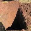
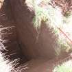
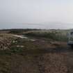
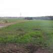
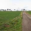
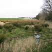
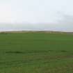
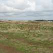
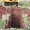
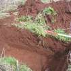
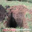
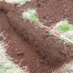
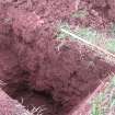
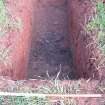
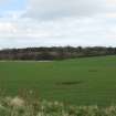
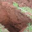
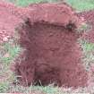
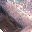
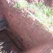
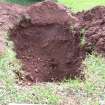
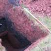
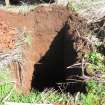
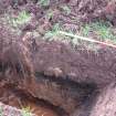
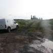
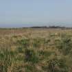
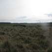
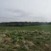
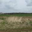
NT 6700 7770 (centred on) A programme of investigative works was undertaken in respect of the development of a new residential complex. An evaluation was carried out from 6–24 October 2008 and comprised 72 trenches in open farmland. The trenches totalled some 12893m2, slightly exceeding the 8% requirement for the study area. A series of potentially significant archaeological features were recorded in the core development area. These consisted of linear features, pit features and a possible occupation layer.
Archive: RCAHMS. Report: East Lothian Archaeology Service
Funder: Persimmon and Taylor Wimpey
Douglas Gordon – Rathmell Archaeology Limited
Excavation (28 November 2013 - 22 April 2014)
A programme of archaeological works was required by Hallhill Development Ltd in respect of the construction of residential properties at Hallhill, Dunbar, East Lothian. This stage of works was required to mitigate the archaeological features identified by the preceding archaeological evaluation (Gordon 2008) of the development area.
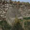
During the strip, map and sample works a total of fourteen features were recorded and excavated that represent anthropic activity. These features represented medieval activity in the form of sherds of pottery recovered from postholes and a find spot of 40 sherds of medieval pottery. However, due to the lack of any substantial structural features associated with the pottery and any dateable artefacts within the linear and pit features their date and functions remain inconclusive
Information from OASIS ID: rathmell1-177665 (Thomas Rees) 2014.

