Carpow
Linear Feature (Period Unassigned)
Site Name Carpow
Classification Linear Feature (Period Unassigned)
Canmore ID 30123
Site Number NO21NW 62
NGR NO 20971 18072
NGR Description NO 2097 1805 to NO 2097 1824
Datum OSGB36 - NGR
Permalink http://canmore.org.uk/site/30123
- Council Perth And Kinross
- Parish Abernethy (Perth And Kinross)
- Former Region Tayside
- Former District Perth And Kinross
- Former County Perthshire
NO21NW 62 2097 1805 to 2097 1824
See also NO21NW 89 and NO21NW 90.
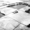
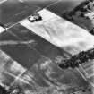
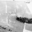
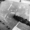
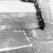
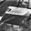
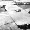
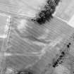
Aerial photography (RCAHMSAP 1983, 1989, 1990 and 1992) has recorded several linear cropmarks on the slope dropping down towards the shore of the Tay to the NE of the Roman legionary fortress NO21NW 24.00. The best defined feature appears to be an old watercourse, forming a dogleg, which has been modified by the construction of a ditch along its E side. Only the lower part of the watercourse can be seen clearly on the photographs, but it turns SW towards the E entrance of the fortress, and may even have served as a routeway down to the river. In addition to the watercourse, some photographs show a ditch dropping straight down the slope from the southernmost corner of the field. Both this ditch and the modified watercourse are intersected by another linear feature, comprising double ditches (NO21NW 89), and there is also another L-shaped length of ditch immediately to the NW (NO21NW 90). The date and purpose of these ditches are unknown.
Information from RCAHMS (JRS), 4 February 1997.
Aerial Photographic Transcription (31 December 1993)
An aerial transcription was produced from oblique aerial photographs. Information from Historic Environment Scotland (BM) 31 March 2017.


