
Following the launch of trove.scot in February 2025 we are now planning the retiral of some of our webservices. Canmore will be switched off on 24th June 2025. Information about the closure can be found on the HES website: Retiral of HES web services | Historic Environment Scotland
Morenish


Field System (Period Unassigned), Head Dyke (Post Medieval), Rig And Furrow (Medieval) - (Post Medieval)
Site Name Morenish
Classification Field System (Period Unassigned), Head Dyke (Post Medieval), Rig And Furrow (Medieval) - (Post Medieval)
Alternative Name(s) Ardmoyle; Ballemore; Tomocrocher; Blarliargan; Rynachulig; Edramucky
Canmore ID 301113
Site Number NN63NW 270
NGR NN 6100 3600
Datum OSGB36 - NGR
Permalink http://canmore.org.uk/site/301113


- Council Perth And Kinross
- Parish Kenmore (Perth And Kinross)
- Former Region Tayside
- Former District Perth And Kinross
- Former County Perthshire
NN63NW 270 6100 3600
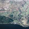
The landscape and field pattern of Morenish, on the north side of Loch Tay, is to a large extent the result of agricultural improvement from the late 18th century onwards, subsequently altered by land-use changes in the later twentieth century, though some elements of an earlier, pre-improvement, field system survive.
The modern Morenish Farm is now centred on land formerly known as Tir Artair (see NN53NE 62). Historically, Morenish was a much larger property, extending from the Allt Tir Artair in the west to the march with Kiltyrie farm in the east; its history has been discussed by Christie (1892, 49-52) and Harrison (2003). In late-medieval times Morenish formed part of the crown lands of Discher and Toyer. By the late-fifteenth century it was held by Menzies of Weem, from whom the Campbells of Glenorchy acquired it by the end of the sixteenth century, though until the 1720s much of the eastern part of the property was wadset to the Campbells of Edramucky. Only when last of the Edramucky line disappeared in 1723, following the murder of a kinsman, did the Glenorchy family, now the earls of Breadalbane, assume full control. Morenish was valued as a thirty merkland, but by the late seventeenth century it appears to have been divided into six holdings, each valued at five merks; from west to east these were Ardmoyle and Ballemore McGrigor (together known as Wester Morenish), Tomocrocher and Blarliargan (Middle Morenish) and Rynachulig and Edramucky (Easter Morenish). The boundaries of the six holdings are mapped on John Farquharson's 1769 Survey of the North Side of Loch Tay (National Archives of Scotland, RHP 973/1, Plans 3, 4 and 5).
Farquharson's survey shows a landscape of small enclosed fields of irregular plan. Pockets of woodland are identified, mostly close to the loch, and the Book of Reference that accompanies Farquharson's survey (NAS RHP 973/2) makes clear that these are almost all recently established plantations. Otherwise, the only indications of improvement appear at Edramucky, where there were 'ruins of an old house' (see NN63NW 4) and the remains of 'stone dykes with rows of trees' – clearly the neglected fragments of a designed landscape around the seat of the Campbells of Edramucky.
Farquharson also shows a head-dyke bounding the upper limit of the enclosed ground. At the western and eastern ends of the area the dyke roughly follows the 300m contour, but above Middle Morenish it rises to about 400m. A second, higher head-dyke is also shown above Easter Morenish, on the farms of Rynachulig and Edramucky. This is identified as the 'New Head Dyke' on Farquharson's 1772 general plan of the lochside (NAS RHP 569), and the ground in between the two dykes is identified in the 1769 Book of Reference as grassland 'lately taken from the muir' (NAS RHP 973/2). It is likely that this second head-dyke reflects an expansion of the cattle trade in the mid-18th century (Boyle 2003, 18)
Compiled a century after Farquharson's survey, the first edition of the OS 6-inch map shows a very different landscape (Perthshire 1867, sheets lxviii and lxix). In place of the irregular enclosures there is a pattern of rectilinear fields bounded by straight dykes, a pattern that may date to the reorganization of settlement on Lochtayside in 1797-8 (Harrison 2003, 65-79). This pattern, though, is not uniform; Wester Morenish had been converted into a large sheep farm in the 1840s, and the fields here are noticeably larger than elsewhere, while a crofting settlement had been established at Blarliargan and Tomocrocher in Middle Morenish (Christie 1892, 51), and this is reflected in the row of small rectilinear fields depicted there. The first edition maps also show a new head-dyke. Generally, it roughly follows the line of the earlier head-dyke, although above Wester Morenish it takes a higher course.
The field pattern visible today is very much that depicted on the first edition maps; only occasional fragments survive of the boundaries mapped in 1769. Both of the head dykes shown in 1769 can be traced, however, surviving as stone-faced banks, as can the drystone head-dyke shown on the OS first edition maps. The ground is now largely given over to pasture, though there is now more woodland than before, especially on Edramucky, where all the land above the public road has been afforested. Finally, several small areas of rig cultivation can be traced (on aerial photographs) in the pasture fields above the road and also in the rough ground near the lochside in Middle Morenish. The rigs are invariably narrow and straight, and may be no older than the early nineteenth century.
Visited by RCAHMS (SDB) May 2004
S Boyle 2003; J Christie 1892; J Harrison 2003 (= RCAHMS MS 1155/6)

