
Carpow


Aqueduct (Roman), Rig And Furrow (Medieval) - (Post Medieval)
Site Name Carpow
Classification Aqueduct (Roman), Rig And Furrow (Medieval) - (Post Medieval)
Canmore ID 30103
Site Number NO21NW 44
NGR NO 20788 17553
NGR Description NO 207 174 to NO 207 177
Datum OSGB36 - NGR
Permalink http://canmore.org.uk/site/30103


- Council Perth And Kinross
- Parish Abernethy (Perth And Kinross)
- Former Region Tayside
- Former District Perth And Kinross
- Former County Perthshire
NO21NW 44 207 174 to 207 177
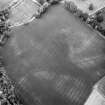
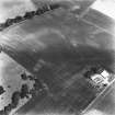
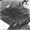
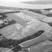
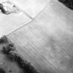
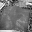
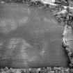
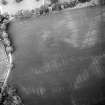
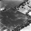
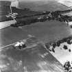
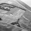
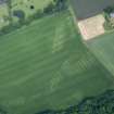
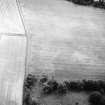
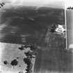
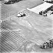
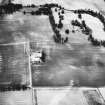
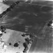
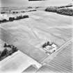
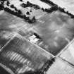
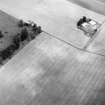
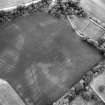
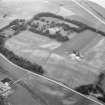
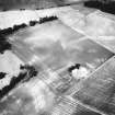
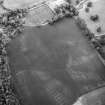
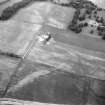
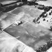
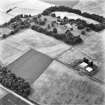
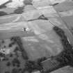
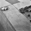
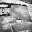
Aerial photography (RCAHMSAP 1977, 1978, 1986, 1991 and 1994) has revealed a linear cropmark which measures about 340m long and marks the course of the aqueduct that supplied water to the Roman fortress at Carpow (NO21NW 24.00) from the higher ground to the S.
The cropmarks of broad rig-and-furrow cultivation can also be seen crossing the line of both the aqueduct and the SW side of the temporary camp NO21NW 58 in the southern half of the field; the furrows are aligned NW and SE, the northern headland roughly coinciding with the perimeter of the Roman enclosure NO21NW 59. Beyond the headland, in the N half of the field there are traces of furrows aligned NE and SW. The position of this headland may indicate that the earthworks of the Roman enclosure were still extant when the cultivation system was laid out.
Information from RCAHMS (JRS), 4 February 1997.
Aerial Photographic Transcription (31 December 1993)
An aerial transcription was produced from oblique aerial photographs. Information from Historic Environment Scotland (BM) 31 March 2017.

