
Edinburgh, Upper Grove Place, General


General View
Site Name Edinburgh, Upper Grove Place, General
Classification General View
Alternative Name(s) Grove Street
Canmore ID 296677
Site Number NT27SW 4644
NGR NT 24342 72981
NGR Description Centred NT 24342 72981
Datum OSGB36 - NGR
Permalink http://canmore.org.uk/site/296677


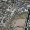
- Council Edinburgh, City Of
- Parish Edinburgh (Edinburgh, City Of)
- Former Region Lothian
- Former District City Of Edinburgh
- Former County Midlothian
NT27SW 4644 centred 24353 72991
Tenemented buildings in Upper Grove Place running SW from Grove Street, depicted on the 1st edition of the OS 6-inch map (Edinburghshire, 1856, sheet 3).

