
Following the launch of trove.scot in February 2025 we are now planning the retiral of some of our webservices. Canmore will be switched off on 24th June 2025. Information about the closure can be found on the HES website: Retiral of HES web services | Historic Environment Scotland
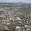
Clydebank, Shelley Drive, Clydebank High School


School (20th Century)
Site Name Clydebank, Shelley Drive, Clydebank High School
Classification School (20th Century)
Alternative Name(s) Janetta Street
Canmore ID 295751
Site Number NS47SE 248
NGR NS 49204 71591
NGR Description Centred NS 49204 71591
Datum OSGB36 - NGR
Permalink http://canmore.org.uk/site/295751

- Council West Dunbartonshire
- Parish Old Kilpatrick (Clydebank)
- Former Region Strathclyde
- Former District Clydebank
- Former County Dunbartonshire
NS47SE 248 centred 49204 71591
Brick built 20th century school situated on the E side of Shelley Drive. First depicted on the Provisional Edition of the 25-inch OS map (Dumbartonshire, 1939). Late 20th century extension to SE with some additional outbuildings.
The sports field occupies site of North east Boquhanran farmstead.
Information from RCAHMS (DE), August 2008

