Pricing Change
New pricing for orders of material from this site will come into place shortly. Charges for supply of digital images, digitisation on demand, prints and licensing will be altered.
Upcoming Maintenance
Please be advised that this website will undergo scheduled maintenance on the following dates:
Thursday, 30 January: 11:00 AM - 3:00 PM
During these times, some functionality such as image purchasing may be temporarily unavailable. We apologise for any inconvenience this may cause.
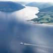
Ardyne Point, Ardyne Oil Platform Construction Yard
Oil Rig Construction Yard (20th Century)
Site Name Ardyne Point, Ardyne Oil Platform Construction Yard
Classification Oil Rig Construction Yard (20th Century)
Alternative Name(s) Loch Striven
Canmore ID 295692
Site Number NS06NE 169
NGR NS 09805 68626
Datum OSGB36 - NGR
Permalink http://canmore.org.uk/site/295692
- Council Argyll And Bute
- Parish Inverchaolain
- Former Region Strathclyde
- Former District Argyll And Bute
- Former County Argyll
NS06NE 169 centred 09805 68626
Abandoned Oil Rig construction yard which extends from NS 09865 69614 to NS 10153 68077 (NS16NW)
Consists of a wharf and two harbours, with a smaller harbour to the N now in use as a fish farm.
Information from RCAHMS (DE), August 2008


