
Following the launch of trove.scot in February 2025 we are now planning the retiral of some of our webservices. Canmore will be switched off on 24th June 2025. Information about the closure can be found on the HES website: Retiral of HES web services | Historic Environment Scotland
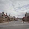
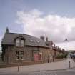
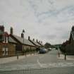
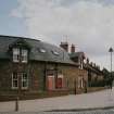
Newtongrange, Lingerwood Road, General


General View (Period Unassigned)
Site Name Newtongrange, Lingerwood Road, General
Classification General View (Period Unassigned)
Canmore ID 290818
Site Number NT36SW 199
NGR NT 33530 63931
NGR Description Centred NT 33530 63931
Datum OSGB36 - NGR
Permalink http://canmore.org.uk/site/290818


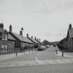
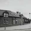
- Council Midlothian
- Parish Newbattle
- Former Region Lothian
- Former District Midlothian
- Former County Midlothian

