Balnabroich
Stone Circle (Neolithic) - (Bronze Age)
Site Name Balnabroich
Classification Stone Circle (Neolithic) - (Bronze Age)
Alternative Name(s) Stylemouth
Canmore ID 29056
Site Number NO15NW 16
NGR NO 10207 56979
Datum OSGB36 - NGR
Permalink http://canmore.org.uk/site/29056
- Council Perth And Kinross
- Parish Kirkmichael (Perth And Kinross)
- Former Region Tayside
- Former District Perth And Kinross
- Former County Perthshire
NO15NW 16 1021 5698.
(NO 102 570) To the NE of Grey Cairn (NO15NW 1) is a stone circle formed by nine boulders giving a diameter of 8 yds. Fragments of charred wood were found near the centre, together with burned bones near the S margin.
J Stuart 1868
At NO 1021 5698, in a low, inconspicuous position is the circle of nine stones described by Stuart, most of them now prostrate. It appears to have measured c. 8.0m in diameter. The stones vary in size from 1.3m long x 0.9m wide and 0.5m long x 0.4m wide, and when standing, the tallest cannot have been much more than 0.9m high - this is in the SW arc.
Surveyed at 1:2500.
Visited by OS (AA) 15 November 1973
Field Visit (May 1987)
Situated on heather-covered moorland about 140m ESE of the Grey Cairn (NO15NW 1), these nine large boulders are set roughly in a circle from 7m to 7.5m in diameter. None of the stones is erect; some are prone and others lean heavily outwards. The larger stones are situated on the S arc and the largest, which measures 1.2m in length and 1m in width, lies recumbent on the WSW. A probable outlying stone is situated some 10m to the NNW.
An excavation (the trenches of which are still visible) carried out in the 19th century (Stuart 1868) recovered 'charred wood' from the centre and 'burned bones' from near the S margin.
Visited by RCAHMS (JRS) May 1987.
RCAHMS 1990.
Measured Survey (5 May 1987)
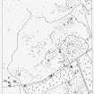
RCAHMS surveyed the stone circle at Balnabroich by alidade and plane-table on 5 May 1987 at a scale of 1:125. The resultant plan was redrawn in ink and published at a scale of 1:250 (RCAHMS 1990, Fig. 59).
Measured Survey (1987)
RCAHMS surveyed the hut circles, field system and Pitcarmick-type buildings at Balnabroich in 1987 at a scale of 1:2500. The resultant plan was redrawn in ink and published at a scale of 1:5000 (RCAHMS 1990, Fig. 108A).


