Accessibility

Font Size

100% 150% 200%

Background Colour

Default Contrast
Close Reset

Kerrera, Seaplane Base

Ammunition Storage Hut(S) (20th Century), Bomb Store (20th Century)

Site Name Kerrera, Seaplane Base

Classification Ammunition Storage Hut(S) (20th Century), Bomb Store (20th Century)

Alternative Name(s) Ardantrive Bay

Canmore ID 289262

Site Number NM83SW 14.01

NGR NM 8450 3099

Datum OSGB36 - NGR

Permalink http://canmore.org.uk/site/289262

Ordnance Survey licence number AC0000807262. All rights reserved.
Canmore Disclaimer. © Bluesky International Limited 2025. Public Sector Viewing Terms

Toggle Aerial | View on large map

Digital Images

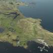
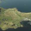
Oblique aerial view centred on the boatyard and the remains of the seaplane base with the house, farmhouse and farmsteading adjacent, taken from the E.
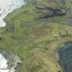
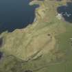
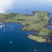
Oblique aerial view centred on the boatyard and the remains of the seaplane base with the house, farmhouse and farmsteading adjacent, taken from the E.Oblique aerial view centred on the boatyard and the remains of the seaplane base with the house, farmhouse and farmsteading adjacent, taken from the NNE.Oblique aerial view centred on the monument and the remains of the ammunition storage huts, taken from the N.Oblique aerial view centred on the monument and the remains of the ammunition storage huts, taken from the NNW.Oblique aerial view centred on the boatyard and the remains of the seaplane base with the house, farmhouse and farmsteading adjacent, taken from the SSW.Oblique aerial viewOblique aerial view centred on the boatyard and the remains of the seaplane base with the house, farmhouse and farmsteading adjacent, taken from the SE.

Collections

Administrative Areas

  • Council Argyll And Bute
  • Parish Kilmore And Kilbride
  • Former Region Strathclyde
  • Former District Argyll And Bute
  • Former County Argyll

Archaeology Notes

NM83SW 14.01 8450 3099

A series of World War II ammunition storage huts forming the bomb store for the flying boat base on Kerrera is situated at the N end of the island.

The earth banked enclosures for the huts are visible on two vertical air photograph sorties (CPE/Scot/UK 247, 4014-4016, flown 31 July 1947 and CPE/Scot/UK 286, 4012-4013, flown 28 August 1947), along eacjh side of a track leading N from the ramp and repair sheds (now a boat yard), most of which are also depicted on the current OS 1:2500 scale map.. The concrete bases for other smaller buildings and structures are also visible on the air photographs.

Information from RCAHMS (DE), June 2007.

References

MyCanmore Image Contributions


Contribute an Image

MyCanmore Text Contributions