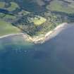
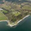
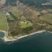
Accessibility

Font Size

100% 150% 200%

Background Colour

Default Contrast
Close Reset

Toward, Slipway

Slipway (Period Unassigned)

Site Name Toward, Slipway

Classification Slipway (Period Unassigned)

Canmore ID 287953

Site Number NS16NW 73

NGR NS 11010 67748

NGR Description NS c. 11010 67748 to NS c. 11059 67762

Datum OSGB36 - NGR

Permalink http://canmore.org.uk/site/287953

Ordnance Survey licence number AC0000807262. All rights reserved.
Canmore Disclaimer. © Bluesky International Limited 2025. Public Sector Viewing Terms

Toggle Aerial | View on large map

Digital Images

Oblique aerial view centred on the South Lodge, with the pier and quay adjacent, taken from the SSE.
Oblique aerial view centred on the South Lodge, with the pier and quay adjacent, taken from the SSE.General oblique aerial view of Castle Toward and policies, taken from the SW.General oblique aerial view centred on Toward Castle, taken from the W.General oblique aerial view centred on Toward Castle, taken from the SW.Oblique aerial view centred on the South Lodge, with the pier and quay adjacent, taken from the NW.General oblique aerial view centred on Toward Castle, taken from the SE.Oblique aerial view centred on the South Lodge, with the pier and quay adjacent, taken from the W.

Collections

Administrative Areas

  • Council Argyll And Bute
  • Parish Dunoon And Kilmun
  • Former Region Strathclyde
  • Former District Argyll And Bute
  • Former County Argyll

Archaeology Notes

NS16NW 73 c. 11010 67748 to c. 11059 67762

Slipway [NAT]

OS 1:10,000 map, 1981.

Not to be confused with Toward Pier (NS16NW 28), to N.

References

MyCanmore Image Contributions


Contribute an Image

MyCanmore Text Contributions