
Pricing Change
New pricing for orders of material from this site will come into place shortly. Charges for supply of digital images, digitisation on demand, prints and licensing will be altered.
Cambusmichael


Enclosure (Period Unknown)
Site Name Cambusmichael
Classification Enclosure (Period Unknown)
Canmore ID 28668
Site Number NO13SW 41
NGR NO 1164 3240
Datum OSGB36 - NGR
Permalink http://canmore.org.uk/site/28668


- Council Perth And Kinross
- Parish St Martins
- Former Region Tayside
- Former District Perth And Kinross
- Former County Perthshire
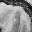
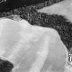
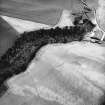
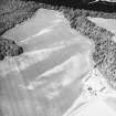
Aerial Photographic Transcription (8 December 1989)
An aerial transcription was produced from oblique aerial photographs. Information from Historic Environment Scotland (BM) 31 March 2017.
Note (June 1992)
NO13SW 41 1164 3240.
For another rectilinear enclosure in the same field, see NO13SW 41.
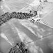
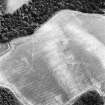
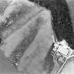
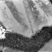
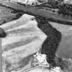
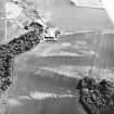
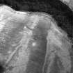
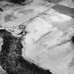
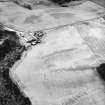
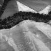
Three sides of what is probably a rectilinear ditched enclosure, measuring at least 70m by 60m, are visible as cropmarks adjacent to the track leading to Cambusmichael church (NO13SW 17). A series of linear cropmarks lie to the N and W. There are also upstanding traces of a bank, possibly no more than an old field-boundary, running down to the edge of the escarpment on the NE side of the track.
Visited by RCAHMS (AW/SH) June 1992.

