Accessibility

Font Size

100% 150% 200%

Background Colour

Default Contrast
Close Reset

Pudding Law

Track (Period Unassigned)

Site Name Pudding Law

Classification Track (Period Unassigned)

Alternative Name(s) Crock Law; Windy Rig

Canmore ID 286490

Site Number NT81NW 228
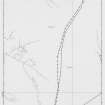
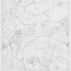
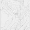
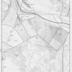
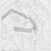
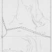
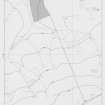
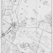
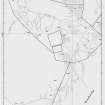
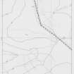
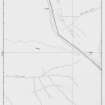
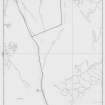
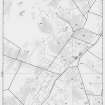
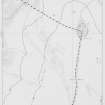
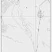
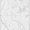
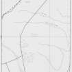
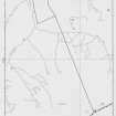
NGR NT 84414 16517

NGR Description From NT 83708 18091 to NT 85639 14914

Datum OSGB36 - NGR

Permalink http://canmore.org.uk/site/286490

Ordnance Survey licence number AC0000807262. All rights reserved.
Canmore Disclaimer. © Bluesky International Limited 2025. Public Sector Viewing Terms

Toggle Aerial | View on large map

Digital Images

Survey drawings: maps of survey area.  Mapsheet 4.
Survey drawings: maps of survey area.  Mapsheet 4.Survey drawings: maps of survey area.  Mapsheet 8.Survey drawings: maps of survey area. Mapsheet 16.Survey drawings: maps of survey area. Mapsheet 20.Survey drawings: maps of survey area. Mapsheet 21.Survey drawings: maps of survey area. Mapsheet 22.Survey drawings: maps of survey area. Mapsheet 24.Survey Drawings: Maps of Survey area.  Mapsheet 28.Survey Drawings: Maps of Survey area.  Mapsheet 34.Survey Drawings: Maps of Survey area.  Mapsheet 35.Survey Drawings: Maps of Survey area.  Mapsheet 35.Survey Drawings: Maps of Survey area.  Mapsheet 41.Survey Drawings: Maps of Survey area.  Mapsheet 47.Survey Drawings: Maps of Survey area.  Mapsheet 48.Survey Drawings: Maps of Survey area.  Mapsheet 51.Survey Drawings: Maps of Survey area.  Mapsheet 54.Survey Drawings: Maps of Survey area.  Mapsheet 55.Survey drawings: maps of survey area.  Mapsheet 13.Survey Drawings: Maps of Survey area.  Mapsheet 26.Survey Drawings: Maps of Survey area.  Mapsheet 26.Survey Drawings: Maps of Survey area.  Mapsheet 29.Survey Drawings: Maps of Survey area.  Mapsheet 29.Survey Drawings: Maps of Survey area.  Mapsheet 31.Survey Drawings: Maps of Survey area.  Mapsheet 31.Survey Drawings: Maps of Survey area.  Mapsheet 37.Survey Drawings: Maps of Survey area.  Mapsheet 39.Survey Drawings: Maps of Survey area.  Mapsheet 44.Survey Drawings: Maps of Survey area.  Mapsheet 47.Survey Drawings: Maps of Survey area.  Mapsheet 48.Survey drawings: maps of survey area.  Mapsheet 3.Survey drawings: maps of survey area.  Mapsheet 4.Survey drawings: maps of survey area.  Mapsheet 7.Survey drawings: maps of survey area.  Mapsheet 7.Survey drawings: maps of survey area. Mapsheet 12.Survey drawings: maps of survey area. Mapsheet 18.Survey drawings: maps of survey area.  Mapsheet 19.Survey drawings: maps of survey area. Mapsheet 23.Survey Drawings: Maps of Survey area.  Mapsheet 27.Survey Drawings: Maps of Survey area.  Mapsheet 33.Survey Drawings: Maps of Survey area.  Mapsheet 34.Survey Drawings: Maps of Survey area.  Mapsheet 38.Survey Drawings: Maps of Survey area.  Mapsheet 42.Survey Drawings: Maps of Survey area.  Mapsheet 44.Survey Drawings: Maps of Survey area.  Mapsheet 46.Survey Drawings: Maps of Survey area.  Mapsheet 55.Survey drawings: maps of survey area.  Mapsheet 5.Survey drawings: maps of survey area.  Mapsheet 10.Survey drawings: maps of survey area.  Mapsheet 11.Survey drawings: maps of survey area.  Mapsheet 18.Survey drawings: maps of survey area. Mapsheet 22.Survey drawings: maps of survey area. Mapsheet 24.Survey Drawings: Maps of Survey area.  Mapsheet 28.Survey Drawings: Maps of Survey area.  Mapsheet 30.Survey Drawings: Maps of Survey area.  Mapsheet 30.Survey Drawings: Maps of Survey area.  Mapsheet 41.Survey Drawings: Maps of Survey area.  Mapsheet 50.Survey Drawings: Maps of Survey area.  Mapsheet 52.Survey drawings: maps of survey area.  Mapsheet 6.Survey drawings: maps of survey area.  Mapsheet 6.Survey drawings: maps of survey area.  Mapsheet 8.Survey drawings: maps of survey area.  Mapsheet 9.Survey drawings: maps of survey area. Mapsheet 14.Survey drawings: maps of survey area. Mapsheet 17.Survey drawings: maps of survey area.  Mapsheet 20.Survey Drawings: Maps of Survey area.  Mapsheet 27.Survey Drawings: Maps of Survey area.  Mapsheet 33.Survey Drawings: Maps of Survey area.  Mapsheet 36.Survey Drawings: Maps of Survey area.  Mapsheet 37.Survey Drawings: Maps of Survey area.  Mapsheet 38.Survey Drawings: Maps of Survey area.  Mapsheet 43.Survey Drawings: Maps of Survey area.  Mapsheet 45.Survey Drawings: Maps of Survey area.  Mapsheet 46.Survey Drawings: Maps of Survey area.  Mapsheet 49.Survey Drawings: Maps of Survey area.  Mapsheet 49.Survey Drawings: Maps of Survey area.  Mapsheet 51.Survey drawings: maps of Survey area.  Mapsheet 1.Survey drawings: maps of survey area.  Mapsheet 2.Survey drawings: maps of survey area.  Mapsheet 11.Survey drawings: maps of survey area.  Mapsheet 15.Survey drawings: maps of survey area. Mapsheet 17.Survey drawings: maps of survey area. Mapsheet 21.Survey drawings: maps of survey area. Mapsheet 23.Survey Drawings: Maps of Survey area.  Mapsheet 32.Survey Drawings: Maps of Survey area.  Mapsheet 32.Survey Drawings: Maps of Survey area.  Mapsheet 36.Survey Drawings: Maps of Survey area.  Mapsheet 39.Survey Drawings: Maps of Survey area.  Mapsheet 50.Survey Drawings: Maps of Survey area.  Mapsheet 54.Survey drawings: maps of survey area.  Mapsheet 12.Survey drawings: maps of survey area. Mapsheet 14.Survey drawings: maps of survey area.  Mapsheet 15.Survey drawings: maps of survey area.  Mapsheet 19.Survey Drawings: Maps of Survey area.  Mapsheet 40.Survey Drawings: Maps of Survey area.  Mapsheet 43.Survey Drawings: Maps of Survey area.  Mapsheet 52.Survey Drawings: Maps of Survey area.  Mapsheet 53.Survey drawings: maps of survey area.  Mapsheet 3.Survey drawings: maps of survey area.  Mapsheet 10.Survey drawings: maps of survey area.Survey drawings: maps of survey area. Mapsheet 16.

First 100 images shown. See the Collections panel (below) for a link to all digital images.

Administrative Areas

  • Council Scottish Borders, The
  • Parish Morebattle
  • Former Region Borders
  • Former District Roxburgh
  • Former County Roxburghshire

Archaeology Notes

NT 84414 16517

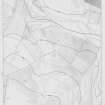
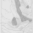
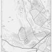
An old trackway was noted during the Bowmont Valley Survey, carried out by Roger Mercer, University of Edinburgh, between 1984-1987. The trackway branches in a number of places, and one branch appears to join the trackway NT81NW 77. The survey ended at the border with England; the track may continue further south.

References

MyCanmore Image Contributions


Contribute an Image

MyCanmore Text Contributions