
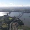
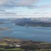
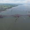
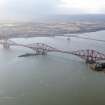
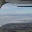
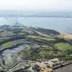
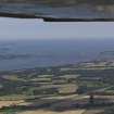
Upper Firth Of Forth, General


General View (Period Unassigned)
Site Name Upper Firth Of Forth, General
Classification General View (Period Unassigned)
Canmore ID 285656
Site Number NT08SE 211
NGR NT 0690 8130
NGR Description Centred NT 0690 8130
Datum OSGB36 - NGR
Permalink http://canmore.org.uk/site/285656


- Council Fife
- Parish Maritime - Fife
- Former Region Fife
- Former District Maritime
- Former County Not Applicable

