
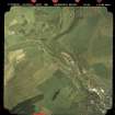
Gala Water, Bridge No.89


Railway Bridge (19th Century)
Site Name Gala Water, Bridge No.89
Classification Railway Bridge (19th Century)
Alternative Name(s) The Waverley Line; Edinburgh To Hawick Branch Railway
Canmore ID 283918
Site Number NT43NE 100.12
NGR NT 47568 37495
Datum OSGB36 - NGR
Permalink http://canmore.org.uk/site/283918


- Council Scottish Borders, The
- Parish Galashiels
- Former Region Borders
- Former District Ettrick And Lauderdale
- Former County Selkirkshire
NT43NE 100.12 47568 37495
Bridge also falls in Caddonfoot parish
Only the brick and sandstone piers and abutments survive of this bridge over the Gala Water. Central pier and lower courses in sandstone the upper section is in brick. The abutments in red sandstaone.
Datestone found on S abutment "F 21x9x91 L" marking high flood level.
Visited by RCAHMS (DE,AL), 20 February 2009
Project (April 2009 - February 2015)
The Borders Railway Project proposals are to reinstate the Newcraighall to Tweedbank section of the former Waverley Line. The reinstated railway line will be approximately 48km long and the majority of the route will use the existing railway embankment.
Several field surveys, archaeological evaluations and standing building surveys were undertaken by CFA Archaeology from April 2009 until February 2015.
CFA Archaeology

