Pricing Change
New pricing for orders of material from this site will come into place shortly. Charges for supply of digital images, digitisation on demand, prints and licensing will be altered.
Westray, Knowe Of Skea
Broch (Iron Age)(Possible), Chambered Cairn (Neolithic)(Possible), Cist (Bronze Age), Hearth(S) (Bronze Age), Inhumation(S) (Bronze Age), Inhumation(S) (Iron Age), Post Hole(S) (Bronze Age), Roundhouse(S) (Bronze Age), Settlement (Prehistoric), Wheelhouse(S) (Iron Age)(Possible), Animal Remains (Prehistoric), Unidentified Pottery (Bronze Age) - (Iron Age), Whetstone (Prehistoric)
Site Name Westray, Knowe Of Skea
Classification Broch (Iron Age)(Possible), Chambered Cairn (Neolithic)(Possible), Cist (Bronze Age), Hearth(S) (Bronze Age), Inhumation(S) (Bronze Age), Inhumation(S) (Iron Age), Post Hole(S) (Bronze Age), Roundhouse(S) (Bronze Age), Settlement (Prehistoric), Wheelhouse(S) (Iron Age)(Possible), Animal Remains (Prehistoric), Unidentified Pottery (Bronze Age) - (Iron Age), Whetstone (Prehistoric)
Alternative Name(s) Berst Ness
Canmore ID 2838
Site Number HY44SW 2
NGR HY 4414 4181
Datum OSGB36 - NGR
Permalink http://canmore.org.uk/site/2838
- Council Orkney Islands
- Parish Westray
- Former Region Orkney Islands Area
- Former District Orkney
- Former County Orkney
HY44SW 2 4414 4181
(HY 4414 4181) Knowe of Skea (NAT)
OS 6" map, Orkney, 2nd ed., (1900).
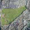
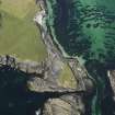
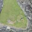
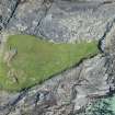
A large, grass-grown cairn lies at the extreme end of Berst Ness. It has an overall diameter of about 85 ft., a height of about 9ft. and has been slightly disturbed on top.
In the immediate neighbourhood, large stones protrude through the turf but they suggest no definite plan.
RCAHMS 1946, visited 1928.
An amorphous, roughly circular, turf-covered mound covering an area about 26.0m in diameter, still known locally as 'Knowe of Skea'. Traces of indeterminate dry-stone structures and midden material protrude from the S. side where it has been eroded by the sea. Not a cairn but an occupation site of uncertain character.
Visited by OS (RL) 1 July 1970.
Two fragments of Iron Age pottery were recovered from a mixture of burnt stone, animal bone and limpet shell in one of a series of exposures on the southern tip of the mound. No structural features were observed.
The pottery is in Tankerness House Museum (Accession no THM 1984.212).
D S Lynn and B Bell 1984.
Five pottery sherds and a whetstone fragment were found in exposures on the S face of the mound. The form of the sherds suggests an Early Iron Age origin. The pot and the remaining size of the severely eroded mound suggest a possible broch site. The finds were deposited in Tankerness House Museum (THM 1990.101 - potsherds and THM 1990.102 - whetstone).
D Lynn and B Bell 1990.
HY 4414 4181 Rescue excavations were carried out on an eroding mound known as the Knowe of Skea (NMRS HY44SW 2) and on several smaller mounds in the near vicinity. The Knowe of Skea is situated at the S extremity of Berst Ness and has previously been interpreted both as a cairn and as a settlement mound. Assessment excavation revealed it to be a chambered cairn. The mound is over 20m in diameter; at its centre is a large oval chamber and there are indications of up to four smaller surrounding cells. The central chamber is unusually large, measuring some 7m by almost 4.5m. It appears to have been deliberately filled in with deposits containing large amounts of fish bone, shell and animal bone; a few sherds of pottery and some worked bone objects have also been found. The surface of the mound was found to be littered with fragments of bone. At least two later Bronze Age burials were inserted into the exterior of the cairn. In one case, the crouched skeleton of a young adult was found in a shallow pit cut into the surface of the cairn. Towards the periphery of the cairn, a stone-lined cist was found set into the cairn. Work has also taken place on a series of five smaller structures on Berst Ness. All have been identified as burial monuments.
Sponsor: Historic Scotland
H Moore and G Wilson 2000
Middle Iron Age burials HY 440 420 A season of excavation was carried out at the Knowe of Skea (HY44SW 2) during autumn 2004. Further human burials, both adults and neonates, were recovered, and two curvilinear buildings were investigated.
Sponsors: HS A, Orkney Islands Council.
HY 4416 4181 A sixth season of excavation was carried out by EASE in 2006. The aim of work carried out during 2006 was to complete the excavation of Structures C and H. The evidience recovered during earlier seasons indicated that the external complex, of which buildings C and H formed a part, was the focus for sustained and intensive activities, including metalworking and human burial. The work was undertaken as a rescue programme, designed to rapidly record a complex site which is actively degrading and ultimately will be destroyed by coastal erosion.
Sponsor: Historic Scotland, Orkney Islands Council, Orkney Archaeological Trust.
Hazel Moore and Graeme Wilson, 2007.
H Moore and G Wilson 2005.
Field Visit (June 1983)
Knowe of Skea HY 4414 4181 HY44SW 2
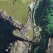
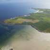
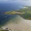
The extremity of the rocky peninsula of Berst Ness is marked by a large settlement mound, about 26m in diameter, in the sea-eroded S side of which can be seen stone walls and midden deposits.
RCAHMS 1983, visited June 1983.
(RCAHMS 1946, ii, p. 357, No. 1049; OR 719).
Field Visit (1998)
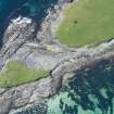
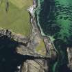
A large amorphous mound, measuring 26m in diameter, is situated on the extreme tip of Berst Ness. The land on which it is situated is being cut off by the sea and is currently joined to the Ness by a low-lying shoulder of sea-washed rock. There are several short exposures to the south side of the mound, caused by coastal erosion. Here, fragments of animal bone, shell, burnt material and pot which may be of Bronze Age date, form inclusions within anthropogenic soil deposits. Occasional protruding stones provide an indication that the mound may cover structural remains. The centre of the mound lies 5m from the coast edge and the site is very vulnerable to further erosion.
Moore and Wilson, 1998
Coastal Zone Assessment Survey
Orkney Smr Note (2000)
At the extreme end of Berst Ness is a large grassed cairn
which has been slightly disturbed on top, 85ft diameter, 9ft
high; in the immediate neighbourhood are large protruding stones.
[R1]
As described, a big settlement-mound.
Information from Orkney SMR (RGL) Jun 81.
Excavation in 2000 revealed that this site was a Neolithic chambered tomb, atypical in plan, the central chamber being very large in comparison with other Orcadian tombs. See Moore and Wilson 2001 for report on excavation.
Information from Orkney SMR
Publication Account (2002)
HY44 9 KNOWE OF SKEA
HY/4414 4181
Possible broch on Westray. In 1990 sherds of Iron Age type [1].
Source: 1. Discovery and Excavation in Scotland 1990, 45.
E W MacKie 2002
Excavation (2007)
HY 44150 41800 A further season of excavation was undertaken at Knowe of Skea in Autumn 2007. The site lies on the coast and is actively eroding. The findings of this season of work include the discovery of two previously unknown structures which, on the basis of architectural form and finds typology, are thought to be of Bronze Age date. Circular/sub-circular in form, they are radially divided inside; one contains a central hearth,
part of a post ring and a large rock-cut pit, and the other has a flagged floor. Further burials of probable Iron Age date were also uncovered.
Archive to be deposited with RCAHMS. Report to be deposited with Historic Scotland and Orkney SMR.
Funder: Historic Scotland, Orkney Islands Council.
Excavation (September 2008)
HY 4416 4181 A further season of excavation was undertaken in September 2008. The focus of the work was Structure J, a roundhouse of probable Bronze – Early Iron Age date. This building is situated to the immediate N side of Structure A, the dominant building and is thought to postdate it. It had two entrances and was divided with radial partitions. The floors of this building were comprehensively sampled and a series of internal features were investigated. The artefact assemblage included skaill knives, stone tools and pottery.
Archive: RCAHMS
Funder: Historic Scotland
H Moore and G Wilson (EASE Archaeology), 2008
Excavation (4 June 2009 - 19 July 2009)
HY 4416 4181 The final phase of excavation was completed 4 June–19 July 2009 and focused on the excavation of two substantial circular stone-walled buildings, Structure J and Structure F, thought to be of Bronze Age date. Both buildings contained internal hearths, post pits and partitions. They had been much altered during their lifetimes. Following its abandonment, Structure J had been deliberately levelled, while part of Structure F was incorporated into a later building. Features of note included the burial of a dog in the entrance of Structure F and the identification of an earlier building, Structure K, beneath Structure J.
Archive: RCAHMS
Funder: Historic Scotland
H Moore and G Wilson – EASE Archaeology
Field Visit (11 May 2015)
ShoreUPDATE
This site has been investigated and partially excavated. No evidence of active erosion faces was found on this visit. Remove from priorities.
Visited by Scotland's Coastal Heritage at Risk (SCHARP) 11 May 2015
Note (2020)
Knowe of Skea
This burial site in Orkney Islands was a focus for funerary practices in the Iron Age period, between 800 BC and AD 200.
Prehistoric Grave Goods project site ID: 60034
CANMORE ID: 2838
Total no. graves with grave goods: 6
Total no. people with grave goods: 8
Total no. grave goods: 9
Prehistoric Grave Goods project Grave ID: 73864
Grave type: Unknown
Burial type(s): Inhumation
Grave good: Animal Bone (Other); Materials used: Bone/Antler/Horn/Ivory/Tooth (Animal) [Bone]; Current museum location: Unknown
Prehistoric Grave Goods project Grave ID: 73866
Grave type: Unknown
Burial type(s): Inhumation, Inhumation
Grave good: Animal Bone (Other); Materials used: Bone/Antler/Horn/Ivory/Tooth (Animal) [Bone]; Current museum location: Unknown
Prehistoric Grave Goods project Grave ID: 73867
Grave type: Unknown
Burial type(s): Inhumation
Grave good: Animal Burial (Specified type); Materials used: Bone/Antler/Horn/Ivory/Tooth (Animal) [Bone]; Current museum location: Unknown
Grave good: Animal Burial (Specified type); Materials used: Bone/Antler/Horn/Ivory/Tooth (Animal) [Bone]; Current museum location: Unknown
Prehistoric Grave Goods project Grave ID: 73868
Grave type: Unknown
Burial type(s): Inhumation
Grave good: Animal Joint/Part (Unknown/Unspecified); Materials used: Bone/Antler/Horn/Ivory/Tooth (Animal) [Bone]; Current museum location: Unknown
Prehistoric Grave Goods project Grave ID: 73869
Grave type: Unknown
Burial type(s): Inhumation, Inhumation
Grave good: Animal Joint/Part (Other specified part); Materials used: Bone/Antler/Horn/Ivory/Tooth (Animal) [Bone]; Current museum location: Unknown
Prehistoric Grave Goods project Grave ID: 73871
Grave type: Unknown
Burial type(s): Inhumation
Grave good: Animal Burial (Specified type); Materials used: Bone/Antler/Horn/Ivory/Tooth (Animal) [Bone]; Current museum location: Unknown
Grave good: Animal Burial (Specified type); Materials used: Bone/Antler/Horn/Ivory/Tooth (Animal) [Bone]; Current museum location: Unknown
Grave good: Animal Burial (Specified type); Materials used: Bone/Antler/Horn/Ivory/Tooth (Animal) [Bone]; Current museum location: Unknown
Further details, the full project database and downloads of project publications can be found here: https://doi.org/10.5284/1052206
An accessible visualisation of the database can be found here: http://blogs.reading.ac.uk/grave-goods/map/


