
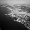
Port Seton Harbour, Slipway


Slipway (19th Century)
Site Name Port Seton Harbour, Slipway
Classification Slipway (19th Century)
Canmore ID 282072
Site Number NT47NW 18.04
NGR NT 40607 75944
Datum OSGB36 - NGR
Permalink http://canmore.org.uk/site/282072

- Council East Lothian
- Parish Tranent
- Former Region Lothian
- Former District East Lothian
- Former County East Lothian

