Accessibility

Font Size

100% 150% 200%

Background Colour

Default Contrast
Close Reset

Cross Port

Landing Point (Period Unassigned)(Possible)

Site Name Cross Port

Classification Landing Point (Period Unassigned)(Possible)

Alternative Name(s) Turnberry; Cross Ports

Canmore ID 281924

Site Number NS20NW 101

NGR NS 200 076

NGR Description NS c. 200 076

Datum OSGB36 - NGR

Permalink http://canmore.org.uk/site/281924

Ordnance Survey licence number AC0000807262. All rights reserved.
Canmore Disclaimer. © Bluesky International Limited 2025. Public Sector Viewing Terms

Toggle Aerial | View on large map

Digital Images

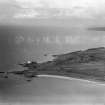
Turnberry Lighthouse and Turnberry Bay.  Oblique aerial photograph taken facing north.  This image has been produced from a damaged negative.

Collections

Administrative Areas

  • Council South Ayrshire
  • Parish Kirkoswald
  • Former Region Strathclyde
  • Former District Kyle And Carrick
  • Former County Ayrshire

Archaeology Notes

NS20NW 101 c. 200 076

Possibly on map sheet NS10NE.

Cross Ports [NAT] (at NS 2005 0767)

OS (GIS) AIB, June 2006.

Cross Port: NS 200 076.

[No source cited].

A Graham 1984.

Graham presumably notes this location as a 'Port' place-name.

Information from RCAHMS (RJCM), 28 June 2006.

References

MyCanmore Image Contributions


Contribute an Image

MyCanmore Text Contributions