Blairhall
Barrow(S) (Prehistoric), Cursus (Neolithic), Drain(S) (Period Unknown), Pit(S) (Period Unknown)
Site Name Blairhall
Classification Barrow(S) (Prehistoric), Cursus (Neolithic), Drain(S) (Period Unknown), Pit(S) (Period Unknown)
Canmore ID 28175
Site Number NO12NW 43
NGR NO 11620 28010
NGR Description From NO 1153 2797 to NO 1171 2803
Datum OSGB36 - NGR
Permalink http://canmore.org.uk/site/28175
- Council Perth And Kinross
- Parish Scone
- Former Region Tayside
- Former District Perth And Kinross
- Former County Perthshire
NO12NW 43 from 1153 2797 to 1171 2803
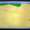
The suspected closed cursus was confirmed by aerial photography and a number of new ring-ditches were also identified by pilots at Perth Aerodrome. Two additional ring-ditches were recorded in line with a row of three already identified, all lying parallel to the cursus and associated with linear cropmarks approximately half-way between the cursus and Gelly Brae Wood. All five ring-ditches appear to have central burials and may be the ploughed out remains of burial mounds. Two similar ring-ditches intersecting the cursus at the eastern end were noted, and two new ring-ditches were identified outside the cursus to the E, at NO 1175 2805 and NO 1175 2810.
M D King 1992.
Aerial Photographic Transcription (23 November 1989 - 15 February 1994)
An aerial transcription was produced from oblique aerial photographs. Information from Historic Environment Scotland (BM) 31 March 2017.
Aerial Photographic Interpretation (14 December 1992)
A probable cursus has been revealed by aerial photography in an arable field 360m S of Blairhall farmhouse. Aligned ENE-WSW, it measures about 190m in length by up to 24m in breadth within a narrow ditch. Several transverse linear marks cut across it, at least one of which (about 75m from the ENE) appears to be an original internal division. However, it is noticeable that the E portion of this division is appreciably wider than the rest, and displays a slight change of alignment. It is, therefore, conceivable that the cursus was built in at least two separate stages. On the ENE, the cursus intersects two probable barrows (NO12NW 32) although their temporal relationship is uncertain, and at the W end of the interior there are traces of a probable ring-ditch.
Information from RCAHMS (JRS) 14 December 1992.


