
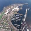
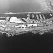
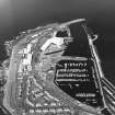
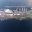
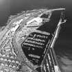
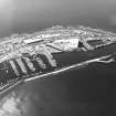
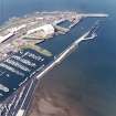
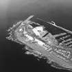
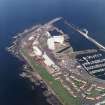
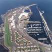
Troon Harbour, Inner Harbour


Dock Basin (Period Unassigned)
Site Name Troon Harbour, Inner Harbour
Classification Dock Basin (Period Unassigned)
Alternative Name(s) Troon Marina; Troon Harbour, Inner Basin
Canmore ID 281415
Site Number NS33SW 23.17
NGR NS 31254 31208
Datum OSGB36 - NGR
Permalink http://canmore.org.uk/site/281415


- Council South Ayrshire
- Parish Dundonald (Kyle And Carrick)
- Former Region Strathclyde
- Former District Kyle And Carrick
- Former County Ayrshire
NS33SW 23.17 31254 31208
Marina [NAT] (at NS 3129 3118)
OS 1:10,000 map, 1986.
Marina [NAT] (at NS 31254 31208)
OS (GIS) AIB, May 2006.

