
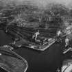
Ayr Harbour, Wet Dock Entrance, Pilot House


Pilot Office (19th Century) - (20th Century)
Site Name Ayr Harbour, Wet Dock Entrance, Pilot House
Classification Pilot Office (19th Century) - (20th Century)
Canmore ID 281318
Site Number NS32SW 123.08
NGR NS 33229 22651
Datum OSGB36 - NGR
Permalink http://canmore.org.uk/site/281318


- Council South Ayrshire
- Parish Ayr
- Former Region Strathclyde
- Former District Kyle And Carrick
- Former County Ayrshire

