
Pricing Change
New pricing for orders of material from this site will come into place shortly. Charges for supply of digital images, digitisation on demand, prints and licensing will be altered.
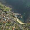
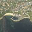
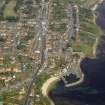
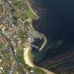
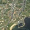
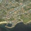
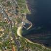
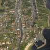
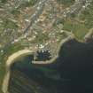
Crail Harbour, South Pier


Pier (Period Unassigned)
Site Name Crail Harbour, South Pier
Classification Pier (Period Unassigned)
Canmore ID 280734
Site Number NO60NW 31.04
NGR NO 61147 07360
NGR Description NO 61147 07360 to 61205 07352 to c. 61237 07376
Datum OSGB36 - NGR
Permalink http://canmore.org.uk/site/280734


- Council Fife
- Parish Crail
- Former Region Fife
- Former District North East Fife
- Former County Fife

