
Dundee, Stannergate, Caledon Street, Eastern Wharf, Ferry Terminal


Ferry Terminal (Period Unassigned)
Site Name Dundee, Stannergate, Caledon Street, Eastern Wharf, Ferry Terminal
Classification Ferry Terminal (Period Unassigned)
Alternative Name(s) River Tay; Firth Of Tay; Port Of Dundee; Dundee Harbour
Canmore ID 280505
Site Number NO43SW 1003
NGR NO 42460 30701
Datum OSGB36 - NGR
Permalink http://canmore.org.uk/site/280505

- Council Dundee, City Of
- Parish Dundee (Dundee, City Of)
- Former Region Tayside
- Former District City Of Dundee
- Former County Angus
NO43SW 1003 42460 30701
For general summary of Dundee Harbour and the Port of Dundee, see NO43SW 109.
Ferry Terminal [NAT]
OS (GIS) AIB, April 2006.
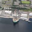
This terminal is situated on the N bank of the River Tay, and at the E end of Eastern Wharf (NO43SW 113).
Information from RCAHMS (RJCM), 18 April 2006.

