
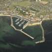
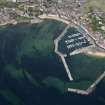
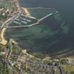
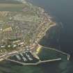
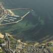
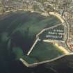
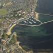
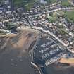
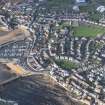
Anstruther Easter Harbour, Inner Basin


Dock Basin (Period Unassigned)
Site Name Anstruther Easter Harbour, Inner Basin
Classification Dock Basin (Period Unassigned)
Alternative Name(s) North-west Basin
Canmore ID 280320
Site Number NO50SE 48.13
NGR NO 56741 03454
Datum OSGB36 - NGR
Permalink http://canmore.org.uk/site/280320


- Council Fife
- Parish Anstruther Easter
- Former Region Fife
- Former District North East Fife
- Former County Fife
NO50SE 48.13 56741 03454

