
Unst, Burragarth


Farmstead (Period Unassigned)
Site Name Unst, Burragarth
Classification Farmstead (Period Unassigned)
Canmore ID 279669
Site Number HP50SE 108
NGR HP 57608 03825
Datum OSGB36 - NGR
Permalink http://canmore.org.uk/site/279669

- Council Shetland Islands
- Parish Unst
- Former Region Shetland Islands Area
- Former District Shetland
- Former County Shetland
HP50SE 108 57608 03825
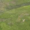
This site was visited as part of the RCAHMS Scottish Farm Buildings Survey. The farmstead is aligned from NE to SW and consists of a detached cottage plus a linear range of outbuildings. The buildings were roofed but in a derelict and dangerous condition on the date of visit.
Information from RCAHMS (ACD) 15 January 2008.
NMRS, MS2560/328.

