
Stobs Camp


Tramway (First World War), Tramway (Second World War), Tramway (20th Century)
Site Name Stobs Camp
Classification Tramway (First World War), Tramway (Second World War), Tramway (20th Century)
Canmore ID 279667
Site Number NT40NE 56.06
NGR NT 4984 0953
NGR Description From NT 4984 0953 to NT 5046 1079
Datum OSGB36 - NGR
Permalink http://canmore.org.uk/site/279667


- Council Scottish Borders, The
- Parish Cavers
- Former Region Borders
- Former District Roxburgh
- Former County Roxburghshire
A 'Meldrum Descructor' was a patented type of rubbish incinerator.
Information from HS/RCAHMS World War One Audit Project (GJB) 7 October 2013.
NT40NE 56.06 from 4984 0953 to NT 5046 1079
Falls on map sheets and NT 51SW
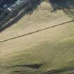
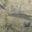
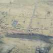
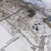
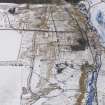
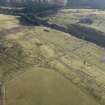
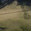
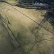
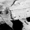
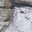
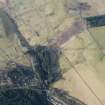
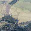
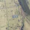
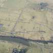
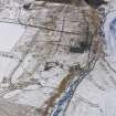
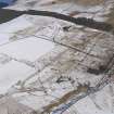
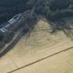
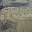
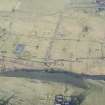
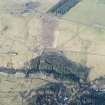
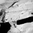
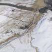
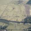
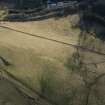
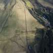
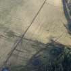
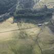
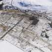
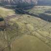
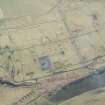
Little survives of a tramway that is depicted on the Revision edition of the OS 6-inch map (Roxburghshire, sheet, c.1920, sheet xxxii), running from exchange sidings (NT51SW 187.13), to the W of the main railway to Hawick (NT 50395 10671) to the NW side of the main camp at Stobs (NT 4984 0953). The tramway was used to assist with the supply of material to the camp.
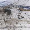
Traces of the tramway are visible on vertical air photographs (106G/Scot/UK 433, 3205-3208, flown 24 June 1945), including the S-bend to the SE of Acreknowe farmsteading. The section immediately NW of the main camp had by the date of the air photogrpahs been destroyed by World War Two expansion. Part of the course of the tramway is also visible on oblique air photogrpahs taken in 1991 (J Dent, Scottish Borders Council).
The tramway linked to a site annotated as the 'Meldrum Destructor' at c.NT 5022 0982, though it is not known what this structure was for.
Information from RCAHMS (DE), March 2006
Excavation (24 October 2017 - 25 October 2017)
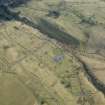
NT 49969 09598 (centred on) A community excavation was undertaken, 24–25 October 2017, which aimed to investigate a section of the path of the narrow-gauge tramway that entered Stobs Camp. The location was chosen as visible linear depressions were observed in the ground. It was also where the tramway split, with one line heading for the camp bakery and one heading to the hospital. To this end, one trench measuring 5.1 x 1m on a NW/SE alignment was opened by hand.
Two bands of a large stone surface were revealed, each c1m wide running approximately NE/SW. Excavating a section in the NW band found that it contained large (0.2m) boulders loosely deposited in a deep cut. Recording was able to measure the depth of the cut to 0.5m but the bottom was not reached. A section in the SE band revealed a shallower concentration of more compacted stones. The height of this band was 0.2m. Finds included broken glass and nails. A larger nail was found and is believed to be a rail spike or crampon.
Archive: NRHE and Scottish Borders Council (intended)
Funder: Heritage Lottery Fund, Historic Environment Scotland, Borders LEADER, Fallago Environment Fund and BCCF Environmental
Andrew Jepson and Dianne Swift – Archaeology Scotland
(Source: DES, Volume 18)

