
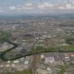
Glasgow, Rutherglen, Bridgeton Bank Sidings


Railway Siding(S) (19th Century) - (20th Century)
Site Name Glasgow, Rutherglen, Bridgeton Bank Sidings
Classification Railway Siding(S) (19th Century) - (20th Century)
Alternative Name(s) Clydebridge Junction; Rutherglen Station
Canmore ID 279158
Site Number NS66SW 971
NGR NS 6145 6230
NGR Description Centred NS 6145 6230
Datum OSGB36 - NGR
Permalink http://canmore.org.uk/site/279158

- Council South Lanarkshire
- Parish Rutherglen (South Lanarkshire)
- Former Region Strathclyde
- Former District City Of Glasgow
- Former County Lanarkshire

