Pricing Change
New pricing for orders of material from this site will come into place shortly. Charges for supply of digital images, digitisation on demand, prints and licensing will be altered.
Rosehaugh Mains
Farmstead (19th Century)
Site Name Rosehaugh Mains
Classification Farmstead (19th Century)
Alternative Name(s) Rosehaugh House Policies
Canmore ID 278291
Site Number NH65NE 30
NGR NH 68095 55384
Datum OSGB36 - NGR
Permalink http://canmore.org.uk/site/278291
- Council Highland
- Parish Avoch
- Former Region Highland
- Former District Ross And Cromarty
- Former County Ross And Cromarty
NH65NE 30 68095 55384.
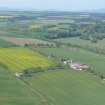
This courtyard farmstead dates from c.1811 and once had central classical arched entrances in the N and S ranges. It was added to in the 1830s and 40s and only the E half of original courtyard survives. There is a three-roomed dwelling, three dwellings with four rooms each, twelve rooms, barns, turnip sheds, a hay shed, stables, horse boxes, loose boxes, piggeries, byres, a dairy byre, a lambing shed, folds, a store, workshops, an engine house and a four-ton weighing machine. Building materials used include stone, lime, wood, slate, corrugated iron and thatch.
There is a smithy, a silage pit and a long, stone, slated and hipped-roofed range across the track to the N. The range has an exterior staircase to the upper floors on the W side, six open bays on the E of the building under flat stone lintels, and there are small granary windows under eaves (2000).
Information from RCAHMS (SS) 23 January 2006.
Former steading complex to Rosehaugh House (itself demolished in the 1950s).
Quadrangle stone built steading, 2 storey with inner courtyard now mostly covered over. L-plan range parallel to the road features plain stone surrounds to regular openings. A large round-headed opening sits at the left end.
Freestanding range to the immediate North of the quadrangle runs N -S. Stone built with slated piend roof over with rooflights. West elevation has a forestair to the upper floor entrance. Ground floor openings are irregular, whilst small lights sit above. East elevation with cart shed openings witj small lights over.
Later smithy (appears on the 2nd edition OS 1:2;500 series but not the 1st) sits to the W of the site.
Single storey 3 bay stone built cottage with bipartite windows sits to the E of the site. Slated roof with gable end chimneys.


