Scheduled Maintenance
Please be advised that this website will undergo scheduled maintenance on the following dates: •
Tuesday 3rd December 11:00-15:00
During these times, some services may be temporarily unavailable. We apologise for any inconvenience this may cause.
Loch Doon Gunnery School, Loch Doon Dam
Tracked Target Range (First World War)
Site Name Loch Doon Gunnery School, Loch Doon Dam
Classification Tracked Target Range (First World War)
Alternative Name(s) Black Burn Knowes; Loch Doon, North Dam
Canmore ID 278251
Site Number NS40SE 44.04
NGR NS 4793 0162
NGR Description NS 4793 0162 to NS 48022 01237
Datum OSGB36 - NGR
Permalink http://canmore.org.uk/site/278251
- Council East Ayrshire
- Parish Dalmellington
- Former Region Strathclyde
- Former District Cumnock And Doon Valley
- Former County Ayrshire
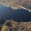
What is described as a monorail railway (by Kirkdale Archaeology) to carry men and material to the target area was built along the eastern side of the loch, for a distance of almost 7km. The monorail was supported on pairs of concrete pillars 2m apart, each pair standing 6m from the previous pair. Only a few of the pillars are now visible above the loch’s waters. The northern terminus lay at NS 4790 0174.
Information from HS/RCAHMS World War One Audit Project (GJB) 12 June 2013.
NS40SE 44.04 4793 0162
For other parts of the Gunnery School see NS40NE 78.00; NX49NE 17.00 and NX49NE 23 -7 and NX49SE 36
Piers for the monorail system built for the Loch Doon Gunnery School during the First World War. Recorded by Kirkdale Archaeology.
Kirkdale Archaeology Report for Loch Doon Action Group
Note (17 June 2013)
Two tracked target systems lie on the E side of Loch Doon, at the N end of the loch. The N example is c.407m and the S example is 427m long. Each tracked target system is the same comprising a line of pairs of concrete blocks some c.7m apart from each other. At either end, the pairs of blocks are widely spaced but narrow until they join together near the middle of the site, before moving apart. The blocks would have supported a track on which the target was placed. How they would have been used is unclear.
They are not part of an alleged monorail system running down the length of the E side of the Loch.
Information from RCAHMS (AKK) 17 June 2013.
Project (March 2013 - September 2013)
A project to characterise the quantity and quality of the Scottish resource of known surviving remains of the First World War. Carried out in partnership between Historic Scotland and RCAHMS.


