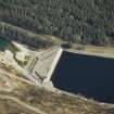
Loch Treig, Dam
Dam (Period Unassigned)
Site Name Loch Treig, Dam
Classification Dam (Period Unassigned)
Alternative Name(s) Lochaber Hydroelectricity Scheme; Fersit; Glen Spean; River Treig
Canmore ID 277888
Site Number NN37NW 8
NGR NN 34782 77143
Datum OSGB36 - NGR
Permalink http://canmore.org.uk/site/277888
- Council Highland
- Parish Kilmonivaig
- Former Region Highland
- Former District Lochaber
- Former County Inverness-shire
NN37NW 8 34782 77182
See also NN37SW 3.
For (associated) Fort William, Aluminium Smelter (centred NN 12556 75030), see NN17NW 16.00.
For associated construction railway, see NN37NW 7.
Dam [NAT]
Sluice [NAT] (at NN 34763 77151)
OS 1:10,000 map, 1992.
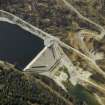
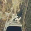
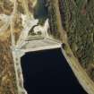
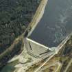
This relatively small dam blocks the River Treig and retains the waters of the lengthy (N-S) Loch Treig.
The map sheet assigned to this record defines the centre of the structure. The available map evidence indicates that it extends from NN c. 34738 77161 to NN c. 34831 77121.
Information from RCAHMS (RJCM), 28 October 2005.
Publication Account (2007)
Loch Treig Dam
(Institute Civil Engineers Historic Engineering Works no. HEW 1435)
Work on the second stage of the Lochaber scheme included building dams to increase the water storage capacity of both Loch Treig and Loch Laggan.
The level of Loch Treig was raised 35 ft by the construction of a 400 ft long rock-fill dam built across the river Treig about 14 mile from the north end of the Loch. This was an early example of a rock-fill dam, and it accorded its engineer international attention. The use of such dams is limited in Highland Scotland because the rocks locally available are often unsuitable schists. The dam, in raising the level of Loch Treig, became the principal reservoir of the scheme and necessitated the diversion of the West Highland Railway for a distance of about 112 miles where it skirted
the Loch.About 1000 men were employed on the construction of the dams. Those working on the Laggan Dam had accommodation at Roughburn camp adjacent to the site whilst those working at Loch Treig were housed at Fersit halfway between the dam sites. Work on both dams was
completed in 1934. The consulting engineer was William Halcrow, and the main contractor was Balfour Beatty & Co. Ltd.
R Paxton and J Shipway, 2007.
Reproduced from 'Civil Engineering heritage: Scotland - Highlands and Islands' with kind permission from Thomas Telford Publishers.
Field Visit (2010)
This dam is an early example of a Rock fill dam, and as such accorded its engineer international attention. The dam is approximately 400 feet long and raises the water level by some 35 feet. Treig is the principal storage for the Lochaber scheme, and receives water from Laggan and Spey via a tunnel. Water is outlet from the dam into a 15 mile long pressure tunnel through to the valve house and surge tower (see separate records). The creation of the reservoir necessitated the diversion of the West Highland Railway line. This dam is was of international significance when it was completed in 1930’s as the first example of a rock fill dam in Scotland. It received coverage in the international engineering press as a major technical innovation. Much of the original fabric is retained with a concrete panel covering to both the upstream and downstream faces. There has been a limited degree of change, including the raising of a parapet wall as per requirements of the reservoirs act. The reservoir created by the Loch Treig Dam necessitated the relocation of the West Highland Railway. J R Hume,1977, 46-7, 204; P L Payne,1988; E Wood, 2002; Concrete and Constructional Engineering IV (1909); Alcan, n.d.; The British Aluminium Co. Ltd, 1930.


