
Pricing Change
New pricing for orders of material from this site will come into place shortly. Charges for supply of digital images, digitisation on demand, prints and licensing will be altered.
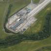
Evanton, New North Bridge


Road Bridge (Period Unassigned)
Site Name Evanton, New North Bridge
Classification Road Bridge (Period Unassigned)
Alternative Name(s) Allt Graad
Canmore ID 277869
Site Number NH66NW 64
NGR NH 61492 66346
Datum OSGB36 - NGR
Permalink http://canmore.org.uk/site/277869


- Council Highland
- Parish Kiltearn
- Former Region Highland
- Former District Ross And Cromarty
- Former County Ross And Cromarty
NH66NW 64 61492 66346
For corresponding road bridge at the SW end of Evanton village, see NH66NW 60.
For predecessor road bridge over the Allt Graad, see NH66NW 62.
For corresponding railway bridge over the Allt Graad, see NH66NW 63.
This short bridge the former line of the A9(T) public road over the Allt Graad to the NE of Evanton village (NH66NW 38).
The location assigned to this record defines the centre of the span.
Information from RCAHMS (RJCM), 28 December 2005.

