
Calamanach Wood


Hut Circle(S) (Prehistoric)
Site Name Calamanach Wood
Classification Hut Circle(S) (Prehistoric)
Canmore ID 27650
Site Number NO06SE 82
NGR NO 0669 6423
Datum OSGB36 - NGR
Permalink http://canmore.org.uk/site/27650


- Council Perth And Kinross
- Parish Moulin
- Former Region Tayside
- Former District Perth And Kinross
- Former County Perthshire
Field Visit (27 September 1988)
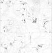
NO06SE 82 0668 6422 and 0670 6424
These two hut-circles are situated on terraces to either side of a post and wire fence 100m WNW of the Dirnanean sheep dip and 60m E of the S corner of Calamanach Wood.
1. NO 0668 6422 The SW hut-circle has been reduced to little more than a shallow scoop 8m in diameter, with a low bank 2m thick and 0.3m high around its SW half.
2. NO 0670 6424 The NE hut-circle has also been reduced to a shallow scoop 8m in diameter, with faint traces of a bank on the SW.
Visited by RCAHMS (SH) 27 September 1988.
RCAHMS 1990

