
Whitefield


Farmstead (Medieval) - (Post Medieval)
Site Name Whitefield
Classification Farmstead (Medieval) - (Post Medieval)
Canmore ID 27648
Site Number NO06SE 80
NGR NO 0859 6178
Datum OSGB36 - NGR
Permalink http://canmore.org.uk/site/27648


- Council Perth And Kinross
- Parish Kirkmichael (Perth And Kinross)
- Former Region Tayside
- Former District Perth And Kinross
- Former County Perthshire
Field Visit (August 1987)
NO06SE 80 0859 6178
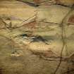
This farmstead comprises five buildings, their walls reduced to stone footings or low banks.
The two larger buildings are set parallel to each other; one is of three compartments and measures 12.1m from WNW to ESE by 3.4m transversely overall, the other is of two compartments, measures 13.5m from WNW to ESE by 4.3m transversely overall and has an outshot at the ESE end.
To the WNW end on opposite sides of a yard there are a two compartment building, measuring 9.5m from WNW to ESE by 3.5m transversely overall and adjoined on the WNW by an open-sided structure, and an apparently open-sided building measuring 8.7m from WNW to ESE by 4.5m transversely overall.
The fifth building, which measures 10.2m from NNW to SSE by 4.4m transversely overall, stands alone, whilst at the foot of crags 39m to the NNW there is a rectangular enclosure measuring 13.7m from NW to SE by 4m transversely within boulder wall-footings.
Visited by RCAHMS (PC) August 1987.
RCAHMS 1990

