Arbroath Airfield, Royal Naval Air Station, Technical Site
Aircraft Hangar(S) (20th Century), Building(S) (20th Century), Church(S) (20th Century), Gymnasium (20th Century), Hut(S) (20th Century)
Site Name Arbroath Airfield, Royal Naval Air Station, Technical Site
Classification Aircraft Hangar(S) (20th Century), Building(S) (20th Century), Church(S) (20th Century), Gymnasium (20th Century), Hut(S) (20th Century)
Alternative Name(s) Hms Condor
Canmore ID 276365
Site Number NO64SW 29.03
NGR NO 61768 43629
NGR Description Centred NO 61768 43629
Datum OSGB36 - NGR
Permalink http://canmore.org.uk/site/276365
- Council Angus
- Parish Arbroath And St Vigeans
- Former Region Tayside
- Former District Angus
- Former County Angus
NO64SW 29.03 Centred 61768 43629
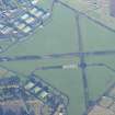
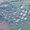
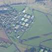
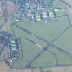
The technical area for Arbroath Airfield encompasses an area of about 46 Hectares and includes various buildings for training, accommodation, aircraft repair sheds and aircraft hangars.
Within the aircraft hangar area are at least two T2 transportable sheds, a naval aircraft repair shop with northlight roof, Bain hangar in use as a electrical repair depot. Other extant buildings include fire tender sheds, naval armoury, naval guard room (NO61408 43428), gym/concert hall (NO 61516 43408).
Training rooms include a Topedo Attck Trainer (TAT) built to design no 1697/42, an AML bomber trainer and a synthetic trainer building. Other surviving wartime structures are a naval latrine and ablutions blockwater tank and pumphouse, naval type squash courts, barrack huts, and a sick bay/medical centre still in use and with few alterations since it was built.
In addition are two churches, one built for the Roman Catholic the other for Presbyterian faiths. One of the churches is of a standard naval type. Elsewhere within the technical area is a modified officer's mess.
The area is visible on postwar vertical air photographs (CPE/Scot/UK 243, 3015-3017, 3039-3041, flown 22 July 1947), which show the approximate situation at the end of WW II with more recent images taken in 1988 (All Scotland Survey (Jasair), 504880 35-504880 37 , flown 14/15 May 1988).
Information from RCAHMS (DE), October 2005


