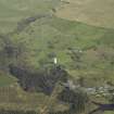
Kendoon Power Station, Surge Tower
Surge Tower (20th Century)
Site Name Kendoon Power Station, Surge Tower
Classification Surge Tower (20th Century)
Alternative Name(s) Water Of Ken; Galloway Hydro-electric Scheme
Canmore ID 276215
Site Number NX68NW 105.02
NGR NX 60716 87930
Datum OSGB36 - NGR
Permalink http://canmore.org.uk/site/276215
- Council Dumfries And Galloway
- Parish Dalry (Stewartry)
- Former Region Dumfries And Galloway
- Former District Stewartry
- Former County Kirkcudbrightshire
Field Visit (2010)
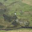
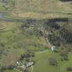
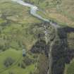
This surge tower protects the buried pipeline linking Blackwater dam and outlet valve with Kendoon powerhouse. It is relatively unusual on a buried pipeline to have an upstanding (rather than buried chamber) surge tower, and it is a striking landscape feature. This surge tower makes a very significant contribution to its landscape setting. It is also relatively unusual for a feature to be made of the surge tower, which is usually formed from a subterranean or semi subterranean chamber. The prominent setting of the surge tower is an example of the confidence and dynamism with which the industry was viewed during this period. P L Payne, 1988, 24; E Wood, 2002, 50; G Hill, 1984.
http://canmore.rcahms.gov.uk/en/site/276215/details/kendoon+power+station+surge+tower/


