Pricing Change
New pricing for orders of material from this site will come into place shortly. Charges for supply of digital images, digitisation on demand, prints and licensing will be altered.
Creag Dubh-leitir, Gleann Fearnach
Township (Medieval) - (Post Medieval)
Site Name Creag Dubh-leitir, Gleann Fearnach
Classification Township (Medieval) - (Post Medieval)
Alternative Name(s) Castle Pirnie Cottage
Canmore ID 27559
Site Number NO06SE 120
NGR NO 0528 6402
Datum OSGB36 - NGR
Permalink http://canmore.org.uk/site/27559
- Council Perth And Kinross
- Parish Moulin
- Former Region Tayside
- Former District Perth And Kinross
- Former County Perthshire
Field Visit (19 January 1989)
NO06SE 120 0526 6404
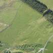
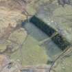
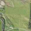
Situated beside a rough track which runs along the edge of a broad natural terrace about 150m SSE of Castle Pirnie cottage, there are the remains of a small fermtoun comprising at least seven buildings and a kiln.
On the terrace to the rear of the fermtoun there are extensive remains of ridge-and-furrow cultivation; scattered throughout the cultivated area there are at least fifteen small cairns, numerous linear clearance heaps and, situated some 30m NE of the fermtoun, a probable burial cairn (NO 06 SE 121). The remains together with those of (NO 06 SE 122), are probably to be identified as 'Ballintuim', which is depicted and named by Roy (1747-55, sheet 17/2), Stobie (1783), Grainger (1818) and Douglas (1826).
A. At the centre of the fermtoun there are two buildings ranged on opposite sides of a yard. That on the NE, which has two compartments, measures 12.2m from NW to SE by 4.8m over footings 0.9m in thickness, and there is an entrance in the SW side; that on the SW measures 13.8m by 4.9m over footings 0.8m in thickness and an entrance on the SW. The latter has an outshot (8m by 4.9m overall) on the NW, also with its entrance on the SW.
B. About 10m SE of the NE building described above, there is a building set at the SW corner of another yard; the building measures 13.8m from NW to SE by 4.9m over turf-covered footings (0.8m thick and 0.5m high) and there is an entrance in the NE side. To the N of the building a pen has been built on to the outside of the yard.
C. To the NNE of the NE building of A, there are the remains of a building measuring 9m WNW-ESE by 4.7m over turf-covered stone wall-footings; there is a possible entrance in the SSW side.
D. Situated immediately to the W of B, there are the remains of a substantial three-compartment building measuring 19.2m WSW-ENE by 5.8m over turf-covered stone wall-footings up to 1m in thickness and 0.4m in height. There is a central entrance in the SSE side and a drainage trench at the rear; what may be the poorly-preserved footings of an earlier building are situated close to the NW corner.
E. The remains of another building lie in a natural hollow to the W of D; it measures 9.3m NNE-SSW by 5.3m over turf-covered stone wall-footings 0.9m in thickness, and the entrance is towards the S end of the E wall.
F. Overlain by a stone dyke, immediately to the S of E, there are the remains of a building measuring 8.8m NNE-SSW by 5.3m over turf-covered stone wall-footings.
G. Situated below the track 12.5m SW of F, there are the wasted remains of a kiln-and-chamber. Overall they measure 10.7m ENE-WSW by 6.6m, and the bowl, which is at the ENE end, is roughly 3.3m in diameter.
Visited by RCAHMS (JRS) 19 January 1989.
RCAHMS 1990.


