Pricing Change
New pricing for orders of material from this site will come into place shortly. Charges for supply of digital images, digitisation on demand, prints and licensing will be altered.
Upcoming Maintenance
Please be advised that this website will undergo scheduled maintenance on the following dates:
Thursday, 9 January: 11:00 AM - 3:00 PM
Thursday, 23 January: 11:00 AM - 3:00 PM
Thursday, 30 January: 11:00 AM - 3:00 PM
During these times, some functionality such as image purchasing may be temporarily unavailable. We apologise for any inconvenience this may cause.
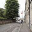
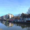
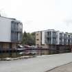
Edinburgh, Union Canal, Leamington Wharf
Wharf (19th Century)
Site Name Edinburgh, Union Canal, Leamington Wharf
Classification Wharf (19th Century)
Alternative Name(s) Edinburgh And Glasgow Union Canal
Canmore ID 272826
Site Number NT27SW 83.14
NGR NT 24401 72644
Datum OSGB36 - NGR
Permalink http://canmore.org.uk/site/272826
- Council Edinburgh, City Of
- Parish Edinburgh (Edinburgh, City Of)
- Former Region Lothian
- Former District City Of Edinburgh
- Former County Midlothian
NT27SW 83:14 244 727
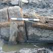
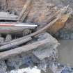
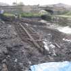
A programme of desk-based assessment, survey, evaluation and excavation was undertaken between February and November 2004 on the S bank of the Union Canal, between the Leamington Lift Bridge and Viewforth Bridge, in advance of a housing development. During the evaluation, a stone quay wall and a timber structure, which turned out to be the stern of a 21m long wooden barge, were uncovered within an area which is to become a mooring for canal boats at the W end of the site. This area was later excavated, during which time the barge was fully uncovered, recorded and moved for further analysis. The stone quay wall and a timber quay wall, which the barge had been incorporated into, were also uncovered. The early to mid-19th-century barge was no doubt used for carrying coal and lime into central Edinburgh, but may also have been used to carry passenger traffic during its life. The barge appears to have gone out of use at the end of the 19th or early 20th century, at which point it was pulled up against the canal bank and built over.
Report lodged with Edinburgh SMR and the NMRS.
Sponsor: Edinburgh Quay Ltd.
R Coleman 2004
Watching Brief (10 February 2004 - 13 February 2004)
NT 243 726 to NT 244 727 A watching brief was conducted in February 2004 on the Union Canal (NT27SW 83.02) between Viewforth Bridge and the Leamington Lift Bridge. The wall that formed the N side of the canal was bulging and about to collapse. Investigations revealed evidence of the clay lining of the canal and the towpath. The original sandstone rubble wall that formed the N side was shown to be little more than a formal edge to the waterway. Apertures in the wall, with sandstone margins,appeared to be water control features. These were later blocked and replaced by cast-iron pipe outlets at a higher level, relating to the development of industry along the canal in the second half of the 19th century.
P Sharman 2004
Sponsor: Historic Scotland
Kirkdale Archaeology
Reference (27 June 2014)
'Leamington Wharf' on the south bank of what was referred to as the Outer or Old Basin is unnamed on the Ordnance Survey 1st edition 25-inch map (Edinburgh, 1851, sheet 38). Two 'Platforms' and two roofed structures are depicted.
By 1876, there are now four roofed buildings (possible for boats or storage) depicted at NT 24347 72605, NT 26381 72627, NT 24408 72646 and NT 24441 72668 (Edinburgh, 1876, sheet 38). The tow path was on the north bank.
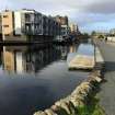
The former Leamington Wharf has been redeveloped.
Information from RCAHMS (MMD), 27 June 2014.


