
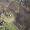
Birnie Parish Church, Burial Ground Extension


Burial Ground (Medieval) - (Post Medieval)
Site Name Birnie Parish Church, Burial Ground Extension
Classification Burial Ground (Medieval) - (Post Medieval)
Canmore ID 272747
Site Number NJ25NW 1.04
NGR NJ 20652 58753
Datum OSGB36 - NGR
Permalink http://canmore.org.uk/site/272747


- Council Moray
- Parish Birnie
- Former Region Grampian
- Former District Moray
- Former County Morayshire
NJ25NW 1.04 20652 58753
For Burial Ground (SAM) see NJ25NW 1.03
For New Cemetery see NJ25NW 47
INVENTORY OF GRAVEYARD AND CEMETERY SITES IN SCOTLAND REFERENCE:
N.B. This reference applies to NJ25NW 1.03, NJ25NW 1.04 and NJ25NW 47 collectively
Address: Birnie Parish Church and New Cemetery, Birnie, Moray
Postcode: IV30 8SU
Status: In current use for burials
Size: Burial Ground (SAM): 0.16 hectares, 0.39 acres
Size: Burial Ground Extension: 0.11 hectares, 0.27 acres
Size: New Cemetery: 0.11 hectares, 0.28 acres
Polygon: Yes
TOIDs: 1000000172541610 (Burial Ground and Extension); 1000000172541501 (New Cemetery)
Number of gravestones: 330
Earliest gravestone: 1694
Most recent gravestone: 2002
Description: Graveyard associated with a church and public cemetery. Burial Ground (NJ25NW 1.03) is roughly circular, surrounding 12th Century Kirk. Pictish Stone in Burial Ground. Burial Ground Extension to N and New Cemetery to W. Early table stones and flat stones, upright stones from 18th Century to present day. Notable stones include one incscribed phonetically and flat stones containing emblems of mortality.
Data Sources: Graveyard Recording Form, 2 August 2002; OS MasterMap checked 10 June 2005; OS 1st Edition(1870-71); OS 2nd Edition (showing Burial Ground Extension)

